

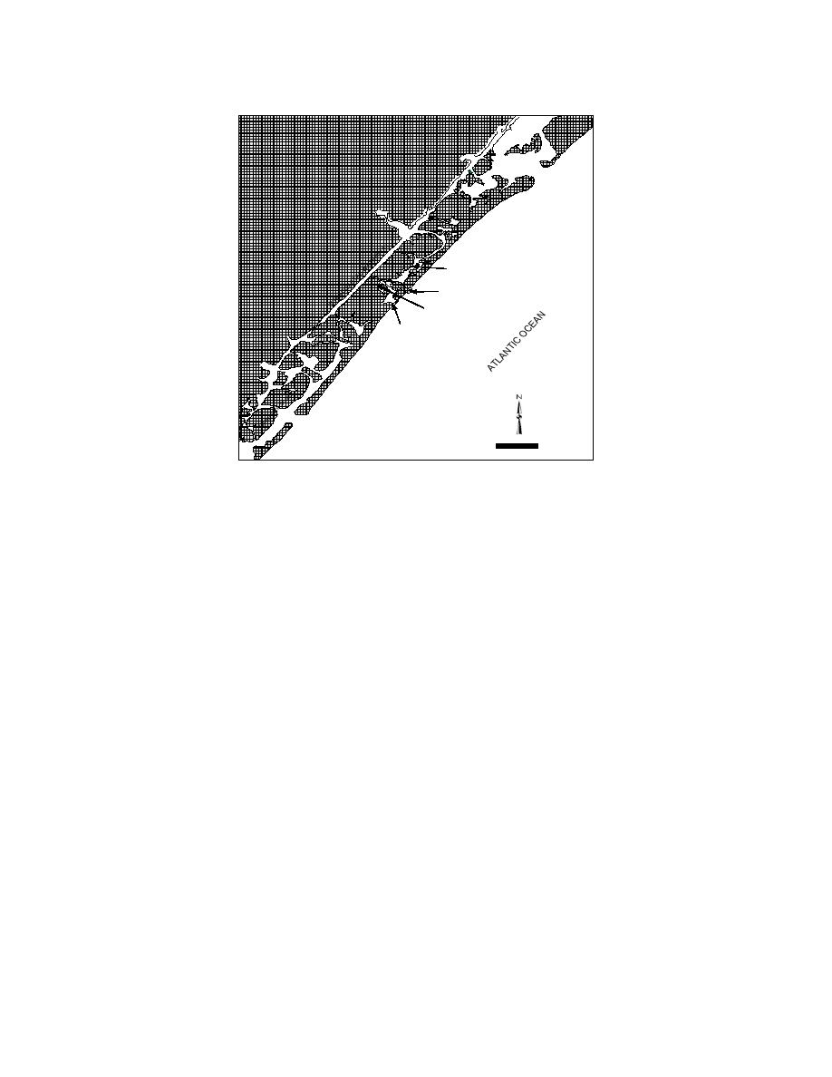
New Hanover
County
Rich Inlet
Banks Channel
Mason Inlet
Relocation
Mason Creek
Old Mason
Inlet
Masonboro
Inlet
0
5000
Scale in Feet
Fig. 1. Study site location map
Mason Inlet is a shallow tidal inlet with 1.2 m (3.8 ft) mean tidal range and 1.5 m (4.8 ft)
mean spring tidal range, connecting the Atlantic Ocean and Banks Channel between Figure Eight
Island and Wrightsville Beach, New Hanover County, North Carolina. The area between the
AIWW and Mason Inlet is the Middle Sound Estuary that encompasses Banks Channel and
Mason Creek tidal channels, numerous small tidal channels, and a broad area of wetland marsh.
As evidenced in photographs from the 1960's and 1970's, Mason Creek was the primary tidal
channel between the AIWW and Mason Inlet prior to development of Figure Eight Island.
During that time, Mason Creek was nominally 1.8 m (6 ft) in depth, and relatively stable.
Following deepening of Banks Channel to a depth of 3.7 m (12 ft) (NGVD), Mason Creek began
to shoal. By 1999, bed elevations in Mason Creek were only -2 to +1 ft (NGVD), and the
resulting tidal flows had shifted from Mason Creek to Banks Channel.
The inlets adjacent to Mason Inlet are the federally maintained, Masonboro Inlet located
8 km (5 miles) to the south and Rich Inlet located some 5.6 km (3.5 miles) to the north. The tidal
flows and tidal prisms at these inlets control the circulation patterns and hydrodynamics of the
Middle Sound Estuary system. In this area, the tides are mixed and semi-diurnal. A month long
study to measure directional currents and water levels within the estuary and adjoining inlets was
pressure gages at seven locations. Computations of tidal prism were performed to develop an
understanding of the existing hydrodynamic system. Flood tidal prisms were computed at
23x106 m3 (809x106 ft3), 11x106 m3 (372)x106 ft3, and 7x10⁵ m3 (25x106 ft3) at Masonboro, Rich,
and Mason Inlets, respectively, based on ADCP measurements taken on July 14, 1999. ADCP
measurements taken biweekly during June and July 1999 confirm these relative values of tidal
prism for the three inlets. Further, based upon prior studies by Jarrett (1976), the reported spring
tidal prism at Masonboro Inlet was 24x106 m3 (855x106 ft3) after construction of the north jetty.
2


 Previous Page
