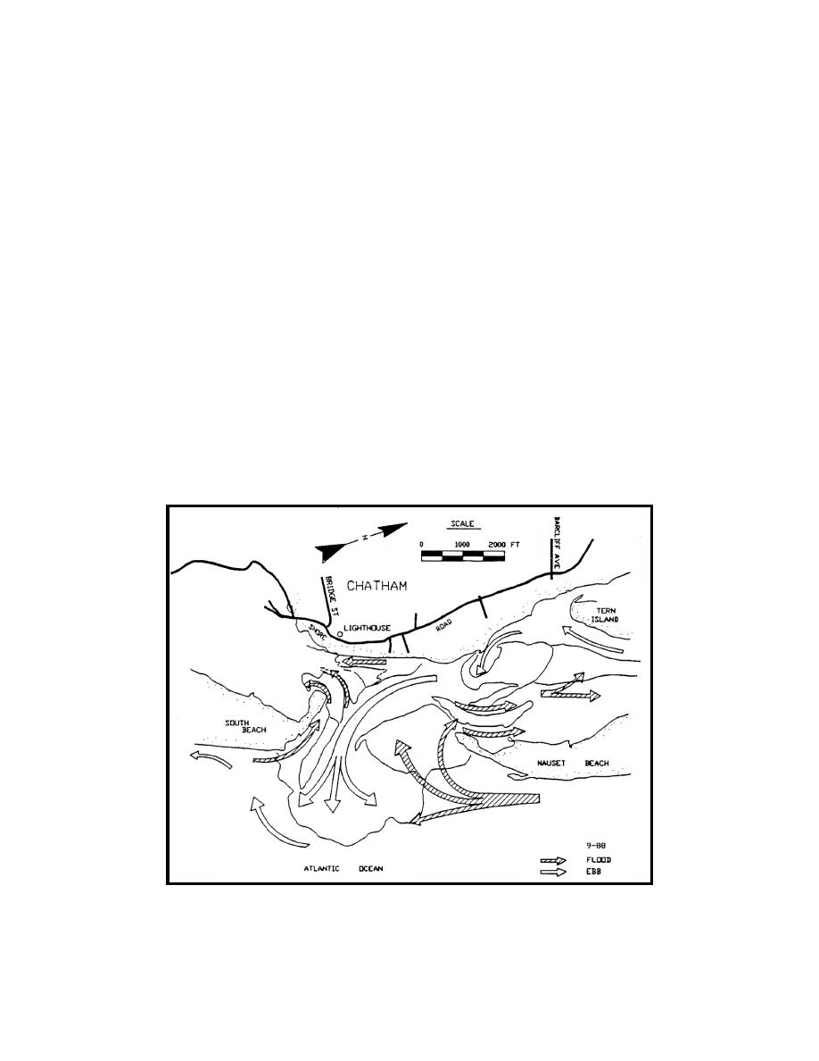
Sediment transport pathways at Chatham Inlet, based on morphology from
September 1988, were presented in Liu et al. (1993) and shown in Figure 48. The
southward moving net longshore transport is diverted into the inlet, particularly on
the flood tide. Sand is transported into the inlet by flood flow over the swash plat-
form, in the main channel and next to the South Beach spit. At that time, the south
flood shoal was composed of two shoals with three channels allowing flood flow
into south Chatham Harbor. Flood flow also moved into north Chatham Harbor
around the north flood shoal. Ebb flow, more confined to the deeper channels,
flowed south around the north flood shoal and out the main ebb channel over the
ebb shoal and continued south along South Beach. Ebb flow was somewhat
blocked from flow out of south Chatham Harbor due to the shallowness of the
south flood shoal. A more detailed sediment transport pathway pattern developed
by Fitzgerald and Montello (1993) and based on the August 1990 aerial photo-
graphs, current measurements, bed form interpretation, and sediment data from
the summer of 1990, is shown in Figure 49.
A similar pattern of flood flow over the swash platform transports sand into
the northern Chatham Harbor. Sand is transported onto the flood tidal shoal, and
up the east and west flood channels. Ebb tidal currents move sand out of the har-
bor, basically, in the east and west tidal channels into the main ebb channel and
out onto the ebb shoal. At this time the South Beach spit had almost attached to
the mainland beach with predominantly flood flow through the gap and prevented
much tidal flow and sediment transport interchange with south Chatham Harbor.
Figure 48. Sediment transport pathways at Chatham Inlet based on morphology
from September 1988 (Liu et al. 1993)
69
Chapter 5 Sediment Pathways


 Previous Page
