292
Inlet Processes, Massachusetts
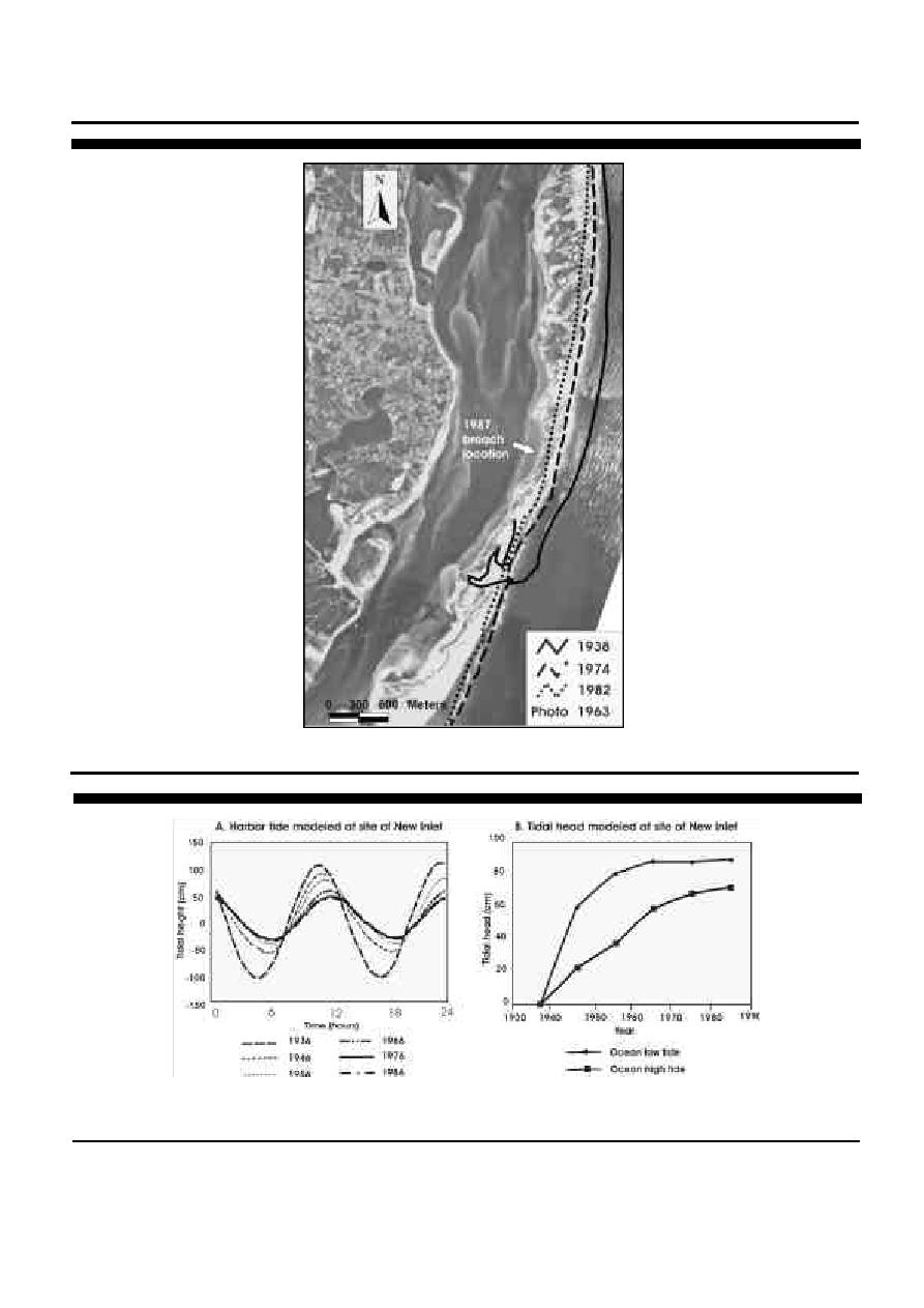
Figure 2.
Shoreline changes of Nauset Spit from 1938 to 1982 as determined from vertical aerial photographs. Note that the amount of
shoreline recession during this period increased in a southerly direction along the spit.
Figure 3.
Numerical model results depicting the evolution of tidal exchange between Pleasant Bay and the ocean from 1936 to 1986: A.
tide in Pleasant Bay/Chatham Harbor, and B. tidal elevation differences across the barrier (redrawn from FRIEDRICHS et al.,
1993).
Journal of Coastal Research, Special Issue 36, 2002


 Previous Page
