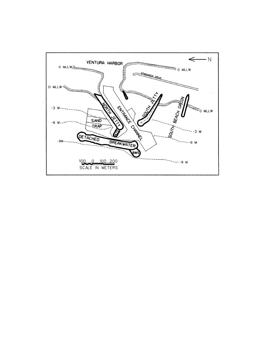
Figure 1: Harbor entrance at Ventura Harbor, California.
scour potential, but the movable-bed model was critical for verifying hypotheses and
designing proper engineering solutions.
Background and History of Ventura Harbor
Ventura Harbor is a man-made commercial and recreational harbor located on the
southern California coast approximately 100 km northwest of Los Angeles, California.
Besides the approximately 200 commercial berths and 1,600 recreational berths, the
harbor provides ocean access to an attached private marina containing 300 boat slips.
The principal structural features of the present-day harbor entrance are two rubble-
mound jetties, a beach groin to the south of the entrance, and a detached rubble-
mound breakwater as shown in Figure 1.
Mean tide range at Ventura Harbor is 1.13 m, and the range between mean-lower-
low water (MLLW) and mean-higher-high water (MHHW) is 1.65 m. Offshore islands
limit wave approach to three relatively narrow corridors: west, southwest, and south.
Ninety percent of the time waves approach from a westerly direction through the
Santa Barbara Channel, creating a southerly drift of littoral material (Hughes and
Schwichtenberg 1998).
Ventura Harbor is located within the Santa Barbara littoral cell between Ventura
River to the north and the Santa Clara River to the south. A 1989 sediment budget
estimated the annual average shoaling rate at Ventura Harbor to be about 490,000
2
Hughes/Schwichtenberg


 Previous Page
