

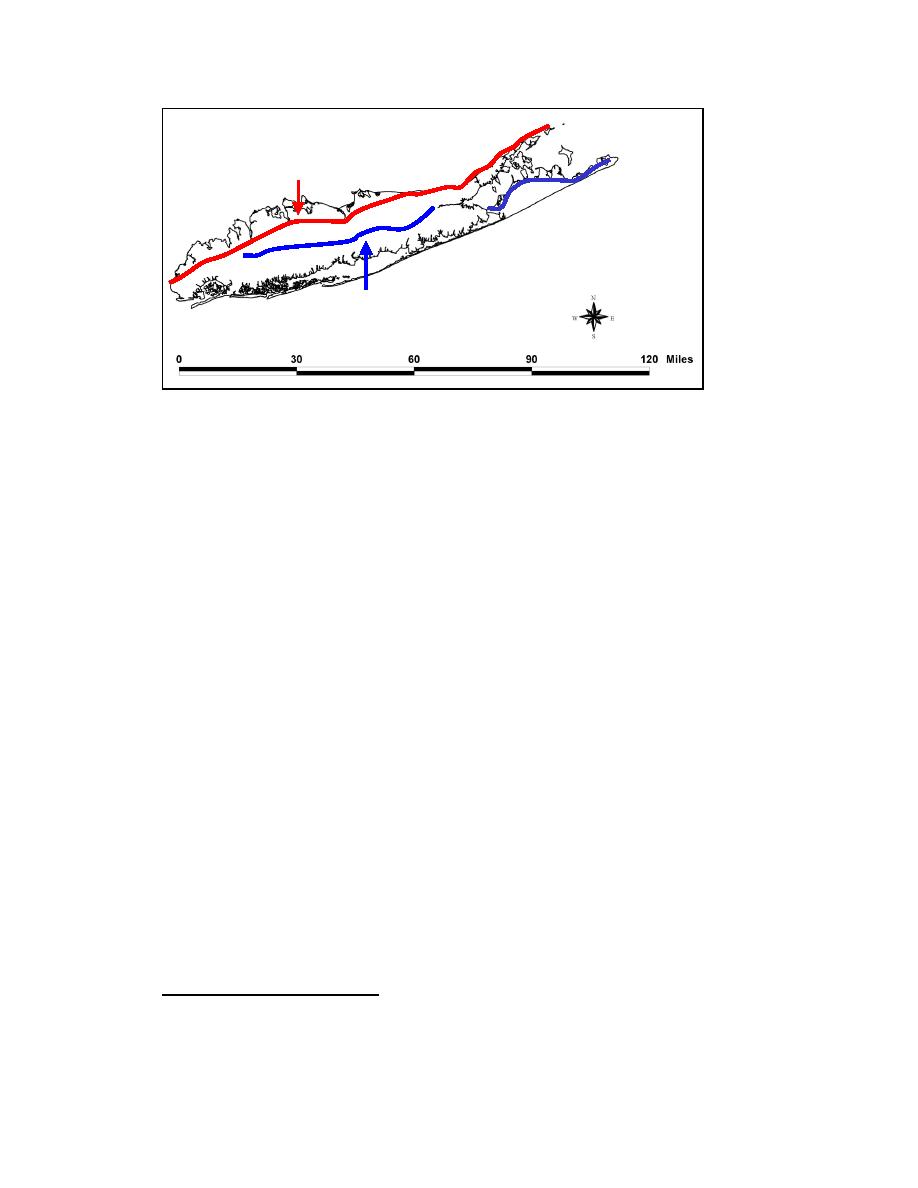
Harbor Hill Moraine
Ronkonkoma Moraine
Figure 2-2. Harbor Hill and Ronkonkoma Moraine locations (approximate)
The eastern portion, where Mattituck Inlet and Goldsmith Inlet are located, largely
comprises steep bluffs separated by headland areas. The remnant headlands (Herod,
Roanoke, Jacobs, Duck Pond, and Horton Points) are composed of clay and till, and are
more resistant to erosion than adjacent areas (New York District 1969). The bluffs are
characterized by loosely consolidated material, as a mixture of moraine material and
glacial outwash, and they are often directly exposed to waves, thus acting as a sediment
Suffolk County portion of the north shore of Long Island and estimated annual recession
rates of 0.5 m/year (1.64 ft/year) at Horton Point, and 0.6 m/year (1.97 ft/year) 0.7 miles
west of Orient Point. Bokuniewicz and Tanski (1983) studied erosion of 50 miles of
coastal bluffs along the eastern end of the north shore of Long Island and concluded that
bluff erosion rates were large enough to satisfy the longshore sediment transport potential
along the eastern portion of the north shore of Long Island. Batten and Kraus (2005)
discuss loss of finer sediments from the beach to the offshore because of the predominant
steep wind waves in the Long Island Sound.
Mattituck Inlet is bounded by two headlands, Jacobs Point to the west and Duck Pond
Point to the east. Goldsmith Inlet is bounded by Duck Pond Point to the west and by
Horton Point to the east (Figure 2-3). Geological evidence suggests that Goldsmith Pond
was once an embayment that was filled by sediment supplied from these headlands. As
sediment deposition narrows the entrance of an embayment, the tidal current increases in
velocity and scouring efficiency. An inlet achieves equilibrium if the deposition caused
by longshore sediment transport is balanced by the erosion caused by tidal current scour
(Johnson 1919). Goldsmith Inlet appears to be an inlet in such a near-equilibrium state.
1
McClimans, R. J. (1970). "Suffolk County bluff and shore recession," U.S. Department of Agriculture,
Soil Conservation Service, Riverhead, NY, unpublished manuscript.
14
Chapter 2 Study Area and Physical Setting


 Previous Page
