January 13, 2004
14:38
WSPC/101-CEJ
00092
D. M. Fitzgerald, G. A. Zarillo & S. Johnston
570
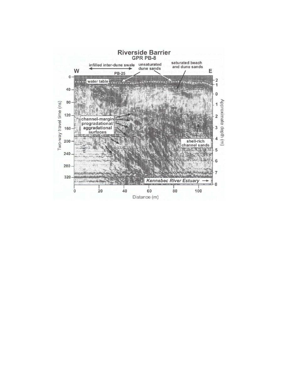
Fig. 2. GPR record of Riverside Beach, which forms the border to Kennebec River Inlet on the
central Maine coast. The pattern of reflectors demonstrates that the channel has narrowed as the
inlet has reached an equilibrium cross sectional area (from FitzGerald et al., 2002).
exposed at low tide (Costa and Glatzel, 2002). These areas were inaccessable by boat
for traditional boat surveys and were difficult to access by land. The LIDAR survey
provided detailed elevation data and improved the results of the hydrodynamic
circulation model (per. comm. Adele Militello).
In the fall of 1995 and the spring of 1996, Assateague National Seashore was
mapped with the ATM (Krabill et al., 2000). The LIDAR surveys were compared to
conventional ground surveys in order to estimate the accuracy of the LIDAR survey.
The error was estimated as the difference between the elevation of the ground survey
and any LIDAR point falling within one meter of the ground survey transect. The
LIDAR survey was collected in November 1995 and the ground survey was collected
that September. The mean error ranged from 0.01 to 0.15 metres. The average error
for all 10 transects was 0.06 metres.
LIDAR surveys have also been used on the West Coast to document a range
of geomorphic responses to the 19971998 El Nino. Locally, some cliff locations
~


 Previous Page
