January 13, 2004
14:38
WSPC/101-CEJ
00092
D. M. Fitzgerald, G. A. Zarillo & S. Johnston
572
One bathymetric LIDAR survey system, the SHOALS (Scanning Hydrographic
Operational Airborne LIDAR Survey) system, was developed by the United States
Army Corps of Engineers (USACE) and has been operational since 1994 (Irish and
Lillycrop, 1999). The SHOALS system works by transmitting a two simultaneous
-- the first, the infrared signal from the water's surface and the second, the green
from the seafloor (USACE 2001). Water depth is determined by the time lapse
between the two signals. The operational depth of the SHOALS system is limited
by water clarity and substrate type. Generally this is not more than 4060 m or 2
3 times the Secchi depth (Irish and Lillycrop, 1999, Parson, Lillycrop, and McClung,
1999, USACE 2001). The SHOALS system also has the capability to map subaerial
areas. The SHOALS system conforms to USACE Class 1 and International Hydro-
graphic Organization Standards (Riley, 1995). The vertical accuracy of the SHOALS
system is 15 cm and the vertical accuracy is 3 m with differential GPS and 1 m
with Kinematic GPS (Irish and Lillycrop, 1999, USACE 2001).
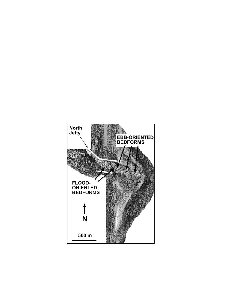
Fig. 4. LIDAR survey of Merrimack River Inlet ebb tidal delta. Note the large sandwaves that are
migrating seaward in the main ebb channel (from FitzGerald et al., 2002).


 Previous Page
