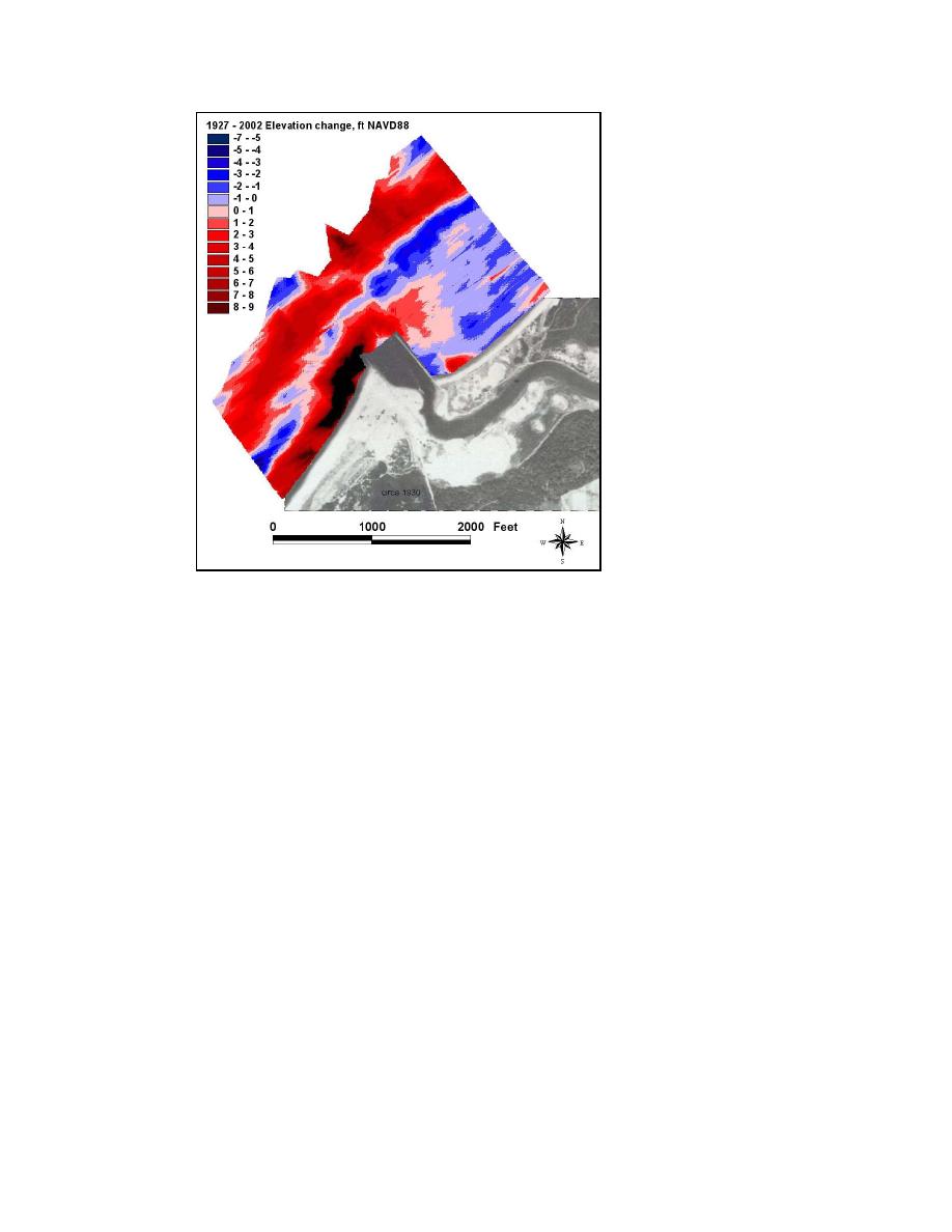
Figure 4-5c.
Mattituck Inlet offshore elevation change, 1927-2002
From 1927 to 1969, the offshore shoal migrated seaward, and this is
indicated in Figure 4-5a as a landward area of erosion and a seaward area of
deposition east of the inlet. West of the inlet, the main longshore bar migrated
seaward as well. The seaward movement of the longshore bar during this period
may be interpreted as a response to shoreline advance, because the shoreline west
of the inlet advanced as a result of sediment impoundment by the west jetty.
The surface difference of the 1969 and 2002 surveys (Figure 4-5b) shows
that the shoal reached locational equilibrium by 1969, and the main longshore bar
west of the inlet had migrated shoreward. This migration may be attributable to
the steepening of the beach slope over this 33-year period (Batten and
Kraus 2005). This period is also characterized by deposition in front of the
offshore shoal and formation of a new longshore bar adjacent to the east jetty,
which apparently acts to bypass sediment to the downdrift beach.
To further investigate and quantify morphology change of the offshore shoal
and patterns of deposition and erosion near Mattituck Inlet, each grid was sub-
sampled, and TINS were generated from which volume change for the three
periods (1927-1969, 1969-2002, and 1927-2002) was calculated. Figure 4-6
illustrates the areas covered in these calculations. The 8 December 1927 survey
did not fully cover the shoal east of the inlet. Volume change calculations for the
western portion of this feature were conducted, as well as a volume change
calculation for the spatial extent of the feature in the 6-8 October 2002 survey for
the period 1969-2002 (Figure 4-7). Polygons A and B cover the seaward and
landward portions of the offshore shoal area, respectively, and polygon C covers
112
Chapter 4 Morphology Change, and Channel Shoaling and Migration


 Previous Page
