Regional sediment management concepts are comprehensive in consideration of policy, the
physical processes that need to be represented, and the predictive tools that must be developed.
This paper describes a thought experiment to examine multiple projects and sediment
management concerns at and around Fire Island Inlet, a moderate-sized inlet located on the
Atlantic coast of New York. The experiment is designed to reveal the interacting problems to be
addressed and potential benefits of regional sediment management with relocation of the inlet.
The hypothesized relocation is not under consideration by the U.S. Army Corps of Engineers.
STUDY SITE SETTING AND MOTIVATION
Fire Island Inlet is one of six permanent inlets located on the south shore of Long Island,
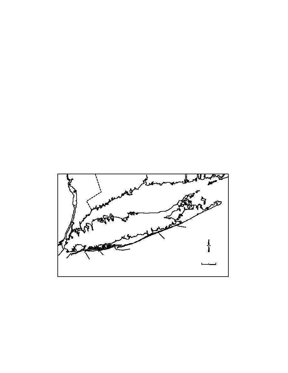
New York. It is classified as a barrier overlap inlet (Fig. 1), indicating that wave-induced sand
transport dominates over transport by tidal exchange. Growth of Fire Island is a well-known
example of spit elongation and owes to longshore sand transport strongly directed to the west.
Westward growth of Fire Island stranded the lighthouse originally built in 1827 (rebuilt in 1854)
at the eastern edge of the inlet. It is now located 8 km to the east of the present inlet entrance
(Fig. 2). Geologists and engineers have studied the Atlantic shore of Long Island and associated
inlets with focus on beach processes for shore preservation and on inlets for navigation and sand
bypassing (e.g., Gofseyeff 1952; Saville 1960; Panuzio 1968; Kumar and Sanders 1974;
Leatherman and Allen 1985; Morang et al. 1999; Smith et al. 1999; Schwab et al. 1999).
Schwab et al. (1999) discuss the geology of the inner continental shelf, sediment sources and
pathways, and evidence of onshore transport of sediment from the shelf toward Fire Island Inlet.
CT
NY
Block Island
Sound
Long Island Sound
NJ
Shinnecock Inlet
Long
Long Island
y
N
h Ba
Sout
Moriches Inlet
reat
G
an
ce
Fire Island Inlet
O
tic
Jones Inlet
n
tla
8 16 km
0
Rockaway E. Rockaway Inlet
A
Inlet
Fig. 1. Location map for the south shore of Long Island, New York
Bottom friction associated with the great hydraulic length of the inlet, presently stretching
6.5 km from the entrance to Great South Bay, weakens the tidal current and promotes shoal
development and closure of the entrance. The photographic record (Fig. 3) and experience in
maintenance dredging indicate that the inlet is prone to shoal, making navigation difficult.
Vessels exiting the inlet must travel abeam to Atlantic Ocean waves before cutting safely south,
although the finger shoals afford protection during lower water. Smith et al. (1999) documented
that approximately 12.2 x 10⁶ m3 of sand was dredged from the entrance from 1954-1994, or
2


 Previous Page
