

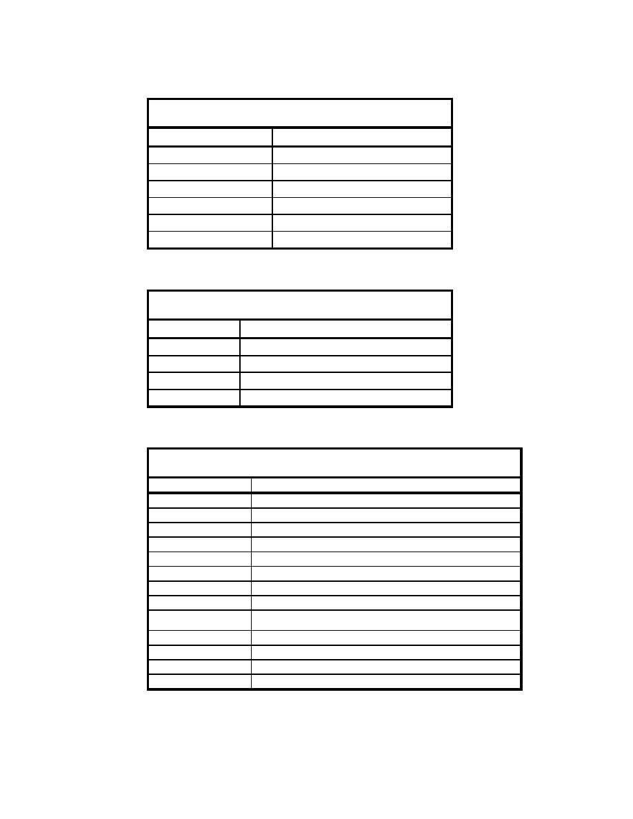
Table D2
Map and Chart Format Codes Used in Appendix C
Format Codes
Map Format
BL
Blue line (Blueprint)
BW
Black and White Copy
CM
Copy Mylar
MY
Mylar (Original)
OR
Original
PP
Photo Print Copy
Table D3
Map and Chart Type Codes Used in Appendix C
Type Codes
Map or Chart Type
BA
Bathymetric (Hydrographic)
NA
Navigation
OT
Other (Explained in Notes)
TH
Thematic (Explained in Notes)
Table D4
Map and Chart Location Codes Used in Appendix C
Location Code
Map Location
EB
Entrance Bay
EC
Entrance Channel
ER
Eel River
FL
Fields Landing Channel, South Bay
HB
Humboldt Bay (Entire Bay)
HC
Hookton Channel, South Bay
MR
Mad River
NB
North Bay (Arcata Bay)
North Channels (Includes North Bay Channel, Eureka Channel Outer
NC
and Inner Reaches, Samoa Channel)
NS
North Spit
OS
Offshore of Entrance
SB
South Bay
SS
South Spit
D3
Appendix D Abbreviations Used for Map and Chart Origins in Appendix C

 Previous Page
