Hurricane Bonnie hitting this coast in 1998 and Floyd making landfall in 1999. These hurricanes
caused both scour and deposition within Mason Inlet. The greatest factors entering these
changes were the sand-rich beaches following nourishment in 1996, 1999 and 2002 and the
height of the storm surge relative to the peak dune elevations (12 to 16 ft) at the inlet.
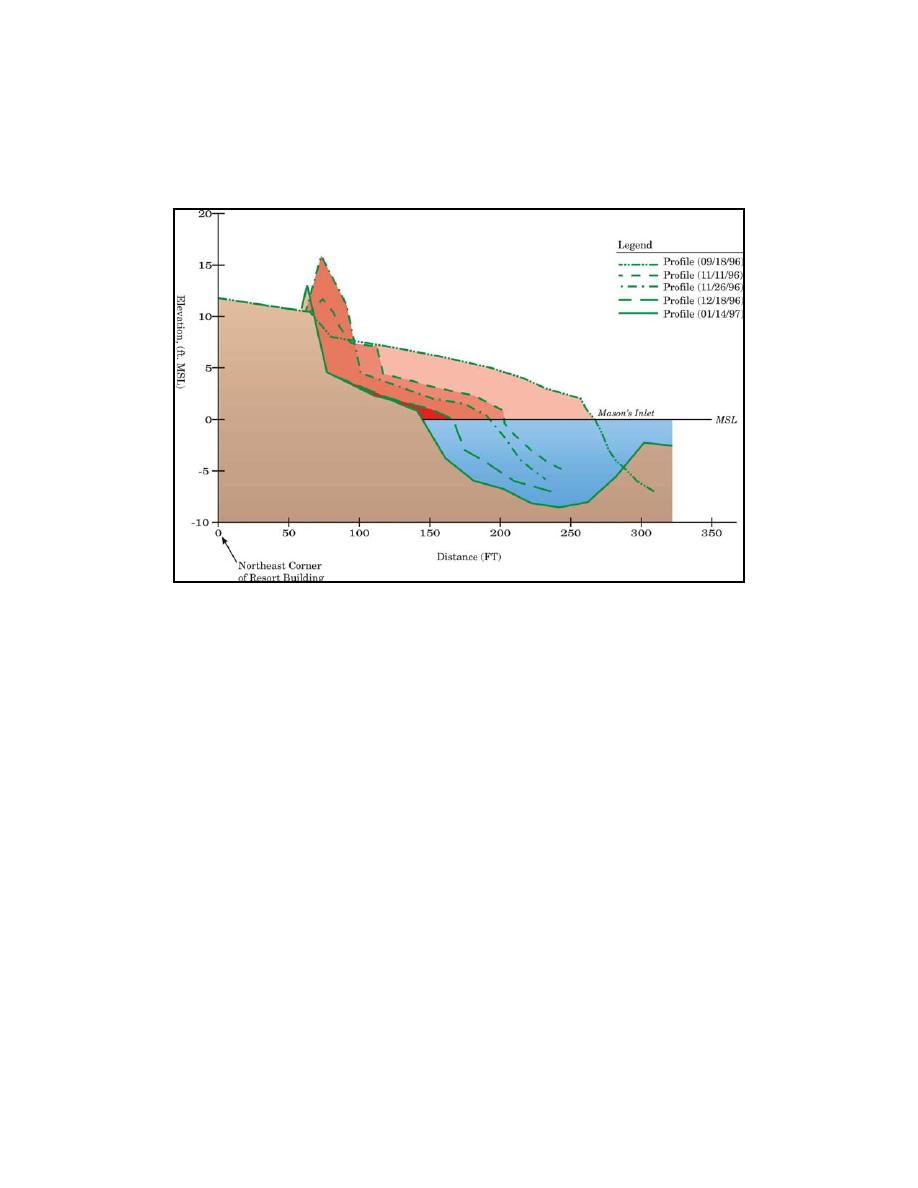
Fig. 4. Shoreline change at Mason Inlet's south channel bank (1996-1997)
Project Design and Engineering
The primary goals of the project were to design a reasonably stable natural inlet along a
designated "inlet corridor," to minimize impacts to the hydrodynamic regime at adjacent inlets,
minimize adverse impacts to bird habitat and marsh losses, and to restore the adjacent updrift
beaches of Figure Eight Island. The primary components the project design called for relocating
the inlet channel approximately 850 m (2,800 ft) north of its 2001 pre-project location. The inlet
channel was dimensioned to insure equal or greater hydraulic capacity than expected based on
flow predictions from a 2D hydrodynamic model of the three inlets and adjoining estuary
system, the historic cross-sectional area of the inlet throat in 1996 and historical mean inlet
widths and depths. The predicted stable cross-sectional area for a tidal prism of 52x106 m3 (170 -
200x106 ft3) indicated that an area of 465 m2 (5,000 ft2) was required. This computed cross-
sectional area was close to the measured May 1996 cross-sectional area of the inlet's throat. To
accomplish the inlet's relocation, the new inlet channel was to be excavated by extending the
Mason Creek channel alignment across the sand spit peninsula that is the southern terminus of
Figure Eight Island. An excavation volume of some 260,000 m3 (340,000 yd3) of medium
grained to coarse sand was required to accomplish the design cross-section through the island.
Mason Creek, which was shoaled and essentially closed, was to be dredged to enhance the
hydraulic flows between the AIWW and the new inlet channel and to reduce flushing times
along the Middle Sound Estuary and the adjoining AIWW. The 18 acre sedimentation basin, or
sand trap, situated at the ocean entrance to Mason Creek, with a holding capacity of 160,650 m3
(210,000 yd3) was designed to capture the sand that would form a flood tidal shoal and prevent
5


 Previous Page
