6000
(a)
Shinnecock Inlet
4000
Moriches Inlet
2000
initial 1931
calc. 1983
Fire Island Inlet
meas. 1983
0
0
20
40
60
80
100
120
140
Distance West from Montauk Point (km)
5200
(b)
Shinnecock Inlet
4800
4400
4000
meas. 1983
Moriches Inlet
3600
initial 1931
calc. 1983
3200
40
60
80
100
120
Distance West from Montauk Point (km)
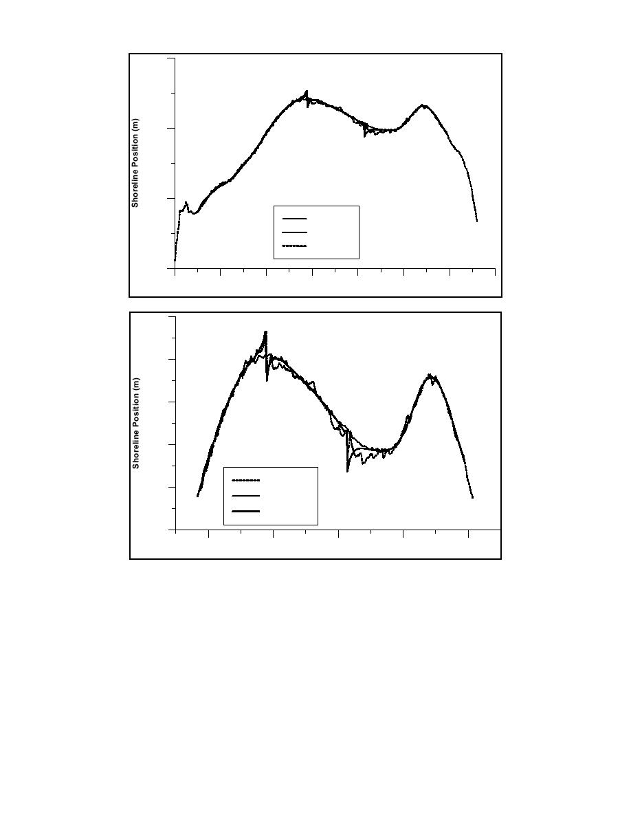
Fig. 6. Comparison between the simulated and measured shoreline 1983 together with the initial
shoreline: (a) overview, (b) detail.
CONCLUSIONS
A numerical model called Cascade was developed to simulate regional sediment
transport and coastal evolution, and it was successfully applied to the south shore of Long
Island, New York. The model can describe time evolution over centuries of coastal
stretches that encompass hundreds of kilometers. Representation of inlets is of special
interest in how they function in the regional sediment transport system in terms of storing
and transferring sediment, with consequences for the adjacent beaches. In Cascade, the
coupling between the regional and local scale occurs in a hierarchical manner, that is,
information is supplied from the regional scale to the local scale. It is expected that this
type of cascading approach may be extended to other scales, either larger or smaller.
Larson, Kraus, and Hanson
12


 Previous Page
