

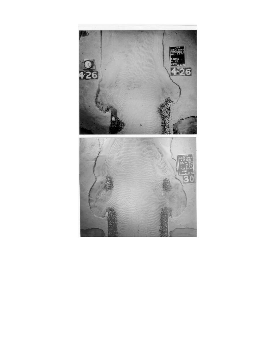
Figure 6. Top photo shows "diamond" end (right side) and a seaward diffraction
structure (left side) and bottom photo shows a mound structure on each side,
bayward of jetties.
shoreline during high water and storm conditions. Earlier maps of the inlet, after the jetties were
built, showed this continuous shoreline through the south jetty also. In the 1936-1939 time frame, the
south jetty crest elevation was increased to +6.1 m, mllw. This addition in elevation was sufficient
to reduce or cut off the sediment supply from the beaches to the inner bank shoreline. As seen in
Figure 7, initially the inner bank was receding eastward, and by 1946 the jetty terminus was exposed.
An eroded region evolved at the south jetty terminus, as seen in the 1960 timeframe. In1960, the
curved notch extended approximately 640 m landward from the jetty terminus, and was recessed
7

 Previous Page
