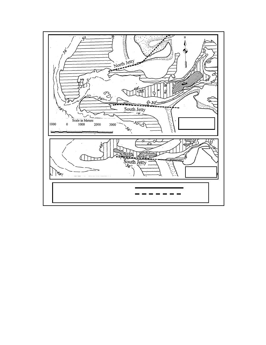
Aug 1929
Aug 1960
Elevation of top of jetty + 20 ft
Elevation of top of jetty <+20 ft
Figure 7. Grays Harbor, Washington, entrance. August 1929, before South
Jetty shoreward portion raised and Aug 1960 about 24 years after south jetty
raised to + 20 ft. Note creation of inner bank erosion area.
200 m laterally into the inner bank. By 1993, the eroded region had increased to dimensions of 730
m long by 275 m wide. From 1946 to 1960, it expanded at a rate of about 46 m/year in length and 14
m/year in width. From 1960 to 1993, the rate of increase was reduced significantly. In late 1993, the
region just south of the south jetty was breached during a storm, and emergency measures had to be
taken to repair the breach. The navigation channel was in close proximity, located on the inner edge
of the south jetty, and tidal flow could potentially enlarge the breach and cause additional erosion to
the region. Increased exposure to wave action was also a possibility for the City of Westport, located
east of the eroded area. The ocean-side beach had also been receding, so the combination of inner
bank erosion and beach recession greatly increased the potential for breaching. The gap was filled
with dredged material in this emergency. To prevent a reoccurrence of the breakthrough, the Seattle
District, U.S. Army Corps of Engineers designed a mound structure based on the conceptual model
experiments of the Coastal Inlets Research Program described above. A model study was conducted
8


 Previous Page
