January 13, 2004
14:37
WSPC/101-CEJ
00097
515
Analytical Model of Incipient Breaching of Coastal Barriers
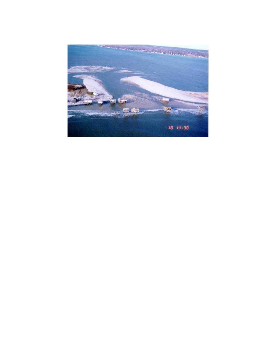
Fig. 2. Pikes Inlet, New York, December 18, 1992, about 6 days after inception of breaching.
Fig. 2. Pikes Inlet, New York, 18 December 1992, about 6 days after inception of breaching.
neighboring, initially smaller breach widened because of updrift trapping of sediment
by a groin field. The latter inlet, called Little Pikes Inlet, grew from approximately
30 m to 1.5 km, more than five times the width of the nearby Moriches inlet to the
west that is stabilized by dual jetties.
General observations and a few case studies of breaching that occurred next to
jetties have also been made, such as for the January 1980 breach at Moriches Inlet,
New York (Schmeltz et al., 1982; Sorensen and Smeltz, 1982) and the December
1993 breach at Grays Harbor, Washington (Arden, 2003). The breach at Grays
Harbor (Fig. 3) was strongly flood dominant, typically flooding even at ebb tide. The
flooding transported a large amount of sediment into the bay and navigation channel.
At both sites, the breach occurred because the beach adjacent to the jetty became
narrow in great part due to erosion or scalloping along the bayside intersection of
the barrier island and jetty (Seabergh, 1999). Kraus and Wamsley (2003) discuss
these and other locations and causes of potential breaching at other inlets stabilized
by jetties in the United States.
Most detailed measurements and numerical models pertain to breaching of dikes,
which differs from coastal breaching by being catastrophic and lasting on the order
of hours, and by the absence longshore sediment transport that would tend to close
19
the inlet. Visser (1998b) summarizes the literature of dike breaching in general
and recent modeling (Steetzel and Visser, 1992; Visser, 1988, 1994, 1998a) and
measurements (Visser, Vrijling, and Verhagen 1990; Visser et al. 1995; de Loof et al.
1996) conducted by the Dutch research community (Kraak et al. 1994).
Concerning predictive numerical modeling, Visser (1994, 1998) describes a five-
stage two-dimensional model of sediment transport and morphology change (depth


 Previous Page
