6
5
Simulated
4
Measured
3
2
1
0
12/27/95
1/16/96
2/5/96
2/25/96
3/16/96
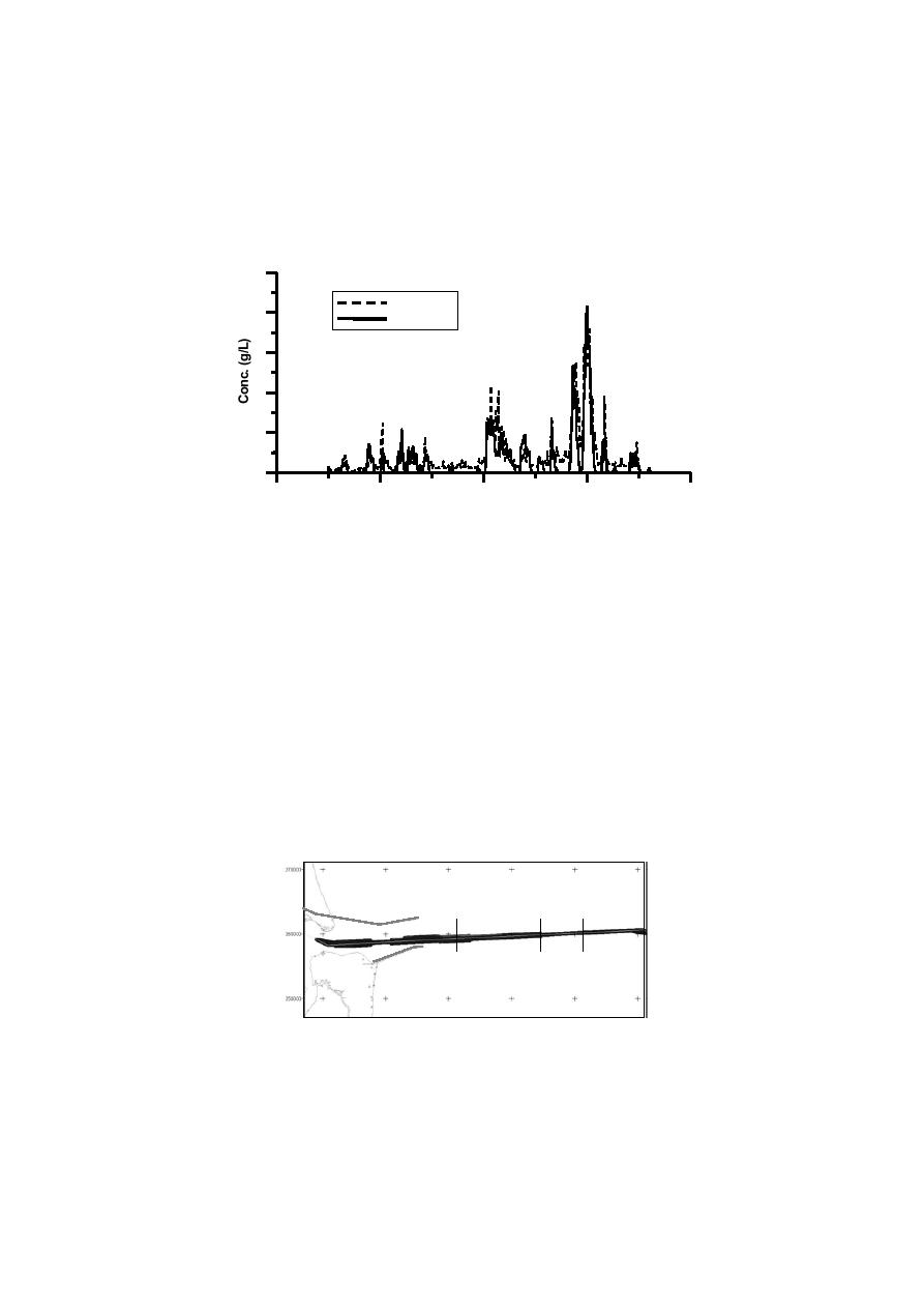
Figure 3. Comparison of near-bottom suspended sediment time series data.
4.
Application to St. Marys Entrance Channel
USACE dredging and surveying data from the approach channel at St. Marys
Entrance, FL-GA, provide an excellent field-scale test for M3D predictive
capabilities. Twenty years of channel cross-section data along the offshore
extent of the channel are available, together with dredging records, detailed
grain size analysis, and wind, wave and current data (Kraus et al 1995; Johnston
et al. 2002). Records indicate that the dredging requirements vary along the
channel. Near the inlet entrance and within and just offshore of the ebb tide
shoal, the sediment is primarily sand, and the dredging requirements are
moderate (~8,000 cy/yr/200 ft of channel). Further offshore, in deeper water,
the sediment becomes more silty, and the dredging requirement is greater
(~ 20,000 cy/yr/200 ft of channel). In deeper water and silty sediments, the
dredging requirements decrease substantially (~500 cy/yr/200 ft of channel).
sta 299
sta 340
sta 180
Figure 4. Station locations along deep-draft channel at St Marys Entrance.


 Previous Page
