January 13, 2004
14:36
WSPC/101-CEJ
00094
543
Progress in Management of Sediment Bypassing at Coastal Inlets
construction of the two previously authorized jetties. Limitation in funding dictated
that the north jetty, due to its location on the apparent up-drift side of the inlet, be
constructed first (Fig. 6) and was completed in 1965. The north jetty was designed
with a weir to aid sand bypassing. This was the first time that a sand weir-bypassing
feature had been incorporated into a US Army Corps of Engineers (USACE) jetty
design. The overall length of the jetty was 1,109 m, with a 530 m long concrete sheet
pile on the landward side of the jetty forming the weir and 579 m of rubble-mound
jetty concstructed seaward. The crest elevation of the shoreward 183 m of the sheet
pile varied from +3.7 m to +0.61 m, mlw, with 335 m long weir section at a crest
elevation of +0.61 m, mlw, approximately at mean tide level. The rubble-mound
portion of the north jetty had design crest elevations varying from +1.8 m to 2.4 m,
mlw.
In 1969, because of the migration of the navigation channel toward the north
jetty, a stone apron was placed to provide toe protection along the rubble-mound
section of the jetty. This migration was not caused by the weir, but was a typical
channel response to a single-jettied system (Kieslich, 1981) where the ebb shoal
collapses in towards the single jetty, forcing the channel against the structure. Con-
struction of the south jetty, built of quarry stone and concrete sheet pile to make it
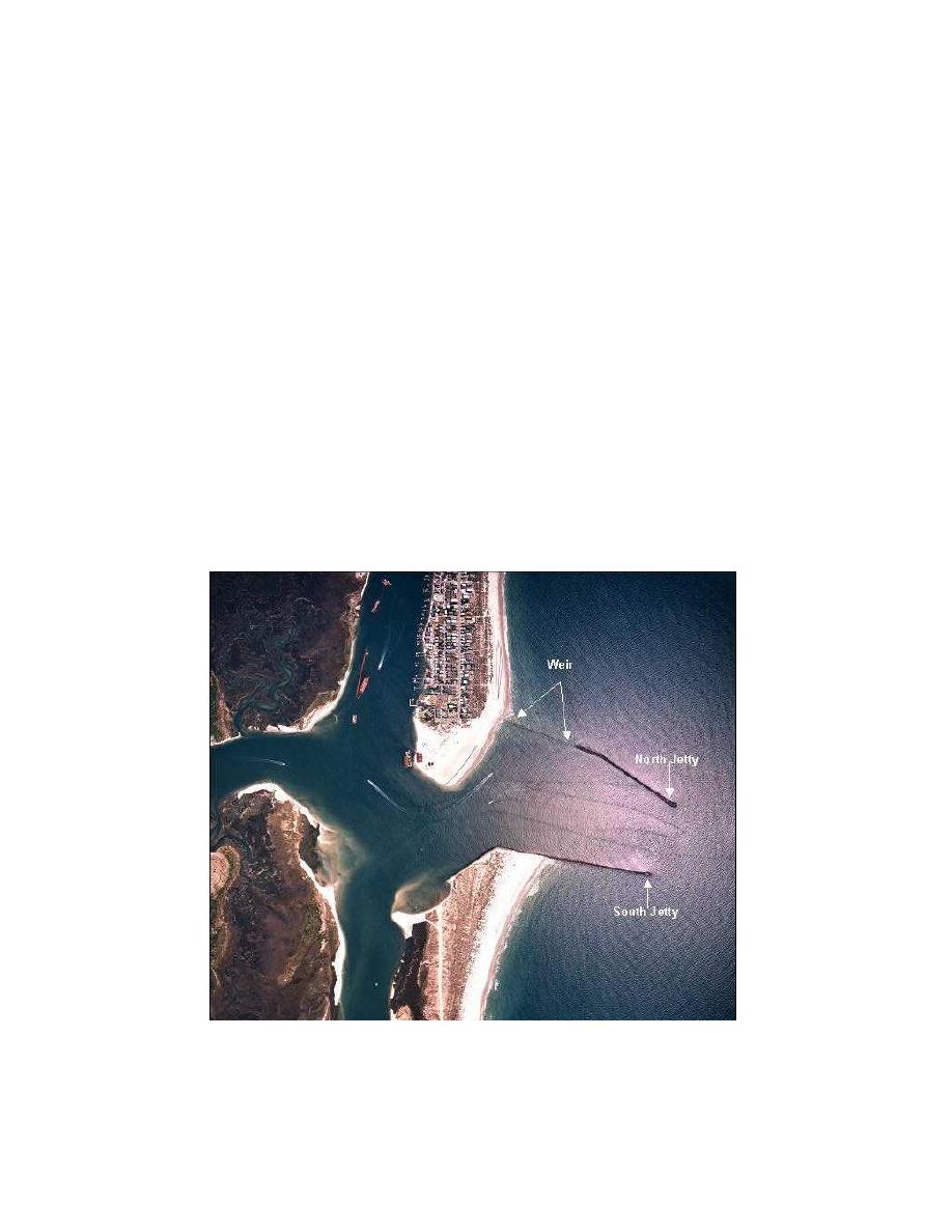
Fig. 7. Masonboro Inlet, North Carolina, after construction of the south jetty.
Figure 7. Masonboro Inlet, North Carolina, after construction of the south jetty.


 Previous Page
