January 13, 2004
14:36
WSPC/101-CEJ
00094
542
W. C. Seabergh & N. C. Kraus
completed in November 1965. The shore-parallel weir arrangement proved beneficial
due to limited wave action in the deposition basin area behind the weir because of
the flat beach slope in front of the weir (Weggel, 1983). This arrangement also
provided a means for regular dredging of the basin without exposing the dredge to
harsh open-water conditions (Coastal Planning & Engineering, Inc., 1991).
3.1.2. Masonboro Inlet, North Carolina
This Inlet has been open continuously since 1733. It migrated southward of its
present position and, in 1909, it was located 1,220 m down-beach from its present
location. Improvements to stabilize its location, authorized in 1949, included two
jetties and an ocean entrance channel between the jetties. The interior channels
were dredged in 1957, and in 1959, the ocean navigation channel was dredged with
design depth of 4.3 m at mean low water (mlw) and 122 m width at the bottom. This
channel shoaled quickly and was reestablished in 1959 (Seabergh, 1976). Continued
shoaling in the channel and attendant maintenance dredging problems led to the
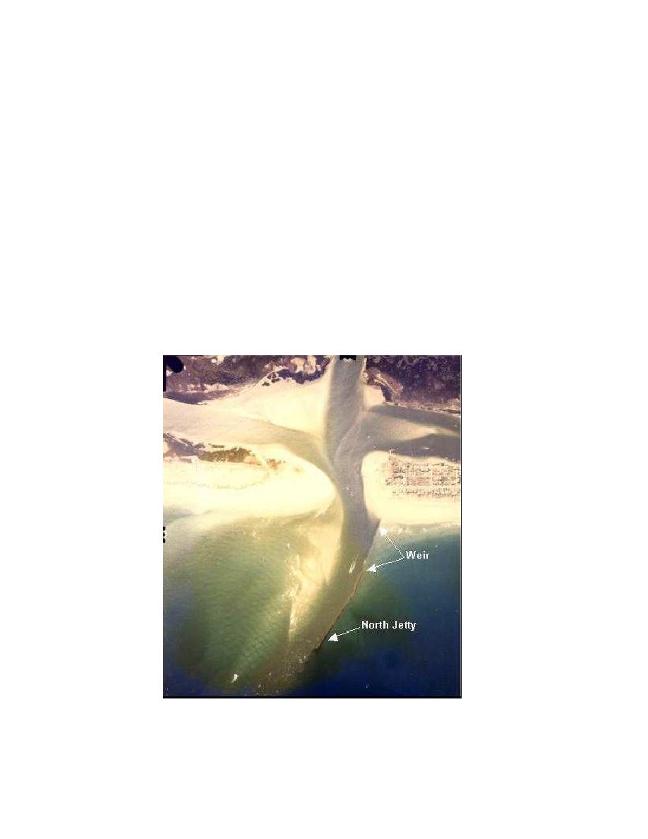
Fig. 6. Masonboro Inlet, North Carolina, 7 years after construction of the north weir jetty (1972).
Figure 6. Masonboro Inlet, North Carolina, 7 years after
construction of the north weir jetty (1972).


 Previous Page
