January 13, 2004
14:36
WSPC/101-CEJ
00094
560
W. C. Seabergh & N. C. Kraus
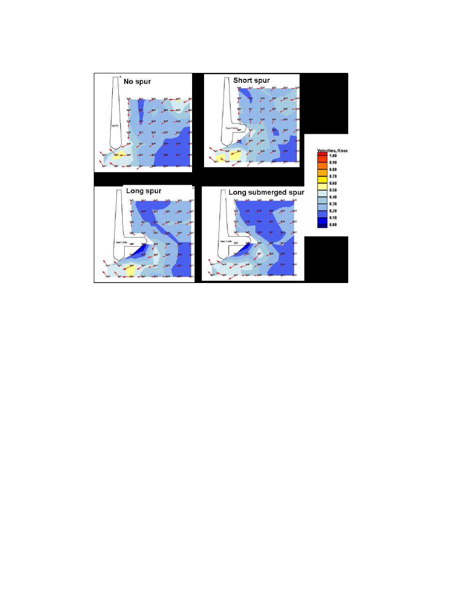
Fig. 18. Detailed velocity fields up-coast of dual jetties for 11 seconds, 3 m waves with maximum
flood current in channel. Dark color contours are slower currents.
Figure 18. Detailed velocity fields up-coast of dual jetties for 11-sec, 3-m waves with
maximum flood current in channel. Dark color contours are slower currents.
Interesting to note are the current deflections along the spurs and the increase in
darker (weaker current) area regions, although changes are small.
5. Discussion and Conclusions
This paper has reviewed and updated information on sediment-bypassing methods
for coastal inlets. Focus was placed on weir jetties and jetty spurs as construc-
tive aids for directing sediment to facilitate sediment handling and reduce sediment
transport into an inlet navigation chann4el. Such engineering works should be con-
1
ducted with the intent of maintaining sediment bypassing between the beaches or
shore adjacent to the inlet. Numerical modeling and physical modeling technology
was described that can aid in the assessments of natural sediment bypassing and
engineering actions to alter and complement natural bypassing.
Previous weir jetty projects were constructed with limited experience in their
response to waves and currents. Examination of these projects shows that adjust-
ments can be performed that should improve their functioning. Spit growth over the
weir has resulted in unwanted bypassing of the deposition basin, causing navigation
channel encroachment and shoaling. Simple changes to offset the basin relative to
the weir edge or use of groins or sediment-training structures can prevent this. Weir


 Previous Page
