

The Federal navigation channel is 100 ft wide at the inlet and 80 ft wide in the
interior. Mattituck Creek makes two sharp turns just south of the inlet. The channel
narrows at the turns, where the greatest sediment shoaling takes place (Figure 2-10).
Mattituck Inlet is characterized by sand-sized sediment, shell, and gravel. A recent grain
size sampling of the navigation channel found the main shoaling areas to be composed
mostly of sand and gravel (New York District 2003).
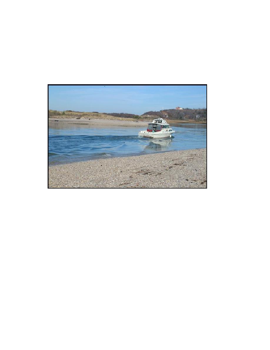
Figure 2-10. Mattituck Inlet channel, after turn eastward inside jetties. Large deposits of
gravel and sand line both sides of channel, 21 November 2003
The Federal navigation channel runs from the inlet entrance to the Village of
Mattituck. The New York District also completed a one-time dredging at the head of
Mattituck Creek in 1965 to create a 460 570 ft Federal anchorage. Suffolk County has
twice dredged this area. In 1955, Mattituck Creek was dredged, resulting in the removal
of 1.5 106 cu yd of sediment (Allee, King Rosen and Fleming, Inc. et al. 1995). In
1967, Long Creek, a tributary of Mattituck Creek, was dredged, removing 13,000 cu yd.
Physical setting
Steep bluffs bound the beaches surrounding Mattituck Inlet. The bluffs are
composed of loosely consolidated moraine material and glacial outwash. The bluffs
reach maximum elevation (160 ft) to the west (Mattituck Hills), where elevations are
consistently greater than 150 ft. The elevation of the bluffs east of Mattituck Inlet
(Oregon Hills) average 100 ft. Narrow beaches front large sections of the bluffs on either
side. These bluffs serve as a primary sediment source for littoral transport, and portions
of this supply have been removed from the littoral system by recent construction of large
retaining walls (Figure 2-11). The offshore on both sides of Mattituck Inlet contains
27
Chapter 2 Study Area and Physical Setting

 Previous Page
