

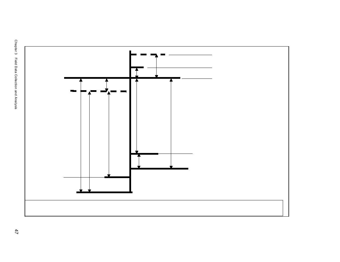
6-8 0ctober 2002 Goldsmith Pond
Mean tide level of Record
0.91 ft
6-8 0ctober 2002 Mattituck Creek
Mean tide level of Record
0.25 ft
NAVD881
6-8 0ctober 2002 Offshore
(NOS Port Jefferson
Mean tide level of Record
0.19 ft
Mean Sea Level
3.22 ft
(NOS Port Jefferson)
2.96 ft
3.3 ft
3.71 ft
3.52 ft
Mean Lower Low Water Mattituck Inlet
(NOS Present Epoch)2
0.26 ft
Mean Lower Low Water Mattituck Inlet
(NOAA 1969 Sea level rise adjustment)2
Mean Low Water
(NOS Port Jefferson)
Mean Lower Low Water
(NOS Port Jefferson)
1
At Port Jefferson, New York, NOS tide gauge (Station ID 8514560), located approximately 48 km west of Mattituck Inlet, 1983-2001 tidal epoch tidal datums mtl and msl
are given as 1.076 and 1.073 m, respectively, and NAVD88 datum is at 1.132 m with respect to mllw
2 At Port Jefferson, New York, NOS tide gauge (Station ID 8514560), mean sea level rise is given as 2.44 mm/year.
Figure 3-1a. Datum elevation differences, Port Jefferson (not to scale)

 Previous Page
