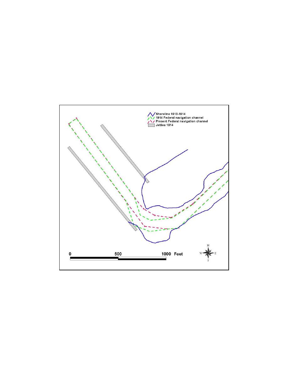
In 1914, the Federal navigation channel was completed by dredging.
Analysis of New York District condition surveys indicate that Mattituck Creek
had been dredged as of a survey dated August 1913 to April 1914. The
morphology of Mattituck Inlet for the period 1913-1914, as listed on the New
York District shoreline survey map, is illustrated in Figure 4-15. Shoals along
the inside of the west jetty had been cleared, shoaling near the base of the east
jetty no longer encroaches upon the Federal navigation channel, and the inlet was
widened along the west bank, directly behind the turn to the east. The
morphology shown here is, therefore, believed to be for a period after the full
dredging of 1914.
Figure 4-15. Mattituck Inlet orientation, 1913/14
Inlet response. This section describes and quantifies sediment shoaling
along the inlet adjacent to the west jetty, sedimentation patterns and shoaling at
the base of the east jetty, the volume and rates of channel infilling, and the area,
volume, and growth of each lobe of the flood shoal for the period 1935 to 1938.
Mattituck Inlet, and the extent of shoaling along the inside of the west jetty, is
shown in Figure 4-16, circa the 1930s (exact year and date unknown). An
apparent landward breach at the base of the east jetty occurred on or around 1935
(Figure 4-17).
122
Chapter 4 Morphology Change, and Channel Shoaling and Migration


 Previous Page
