

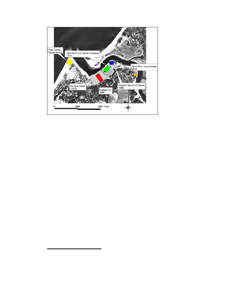
Figure 4-30. Mining related companies and locations at Mattituck Inlet
The only estimated volume information is that given by Ralston (1928) in
reference to "50 cu yd, daily." This figure translates to 10,000 cu yd annually
(for 200 working days). Known Federal dredging permits cover a time period of
approximately 30 years. Given the evidence of commercial activity associated
with sediment mining, the possibility of substantial undocumented mining at
Mattituck Inlet is strong, as is the evidence that mining practices continued
beyond the 1940s. The authors of the present study therefore estimate that from
250,000 to 500,000 cu yd of sediment was removed from Mattituck Inlet from
1920 to 1970.
The extent of sediment mining on the beach directly west of the west jetty is
unclear as well. Schubel (1976) documents mining of sand and gravel from the
beach directly west of the west jetty for the period 1960-1975, under permit of
the Mattituck Park District (Table 2-8). The area of permitted removal was
bounded by the hwl, a line "parallel to and 25 yards from the west jetty" and a
second parallel line located near a refreshment stand (Schubel 1976). According
to local sources, these activities have continued "on and off" for a period of over
50 years, up to 1976.1 Analysis of aerial photographs from 11 May 1955 (Figure
4-29d) and 1 April 1964 (Figure 4-29e) support the presence of mining activities
at this location prior to 1960. The noted area would normally experience a net
gain of sediment through jetty impoundment, and the aerial photographs indicate
shoreline recession.
1
Personal Communication, 30 August 2004, Mr. Frank Murphy, Mattituck Park District
Supervisor (retired).
149
Chapter 4 Morphology Change, and Channel Shoaling and Migration

 Previous Page
