

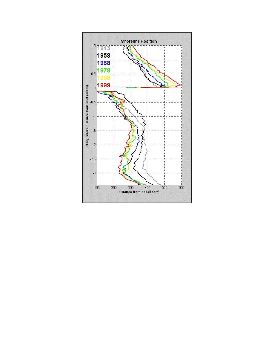
Fig. 6. Comparison of shorelines mapped from
aerial photography between 1943 and 1999.
Table 1 lists the calculated volumes for the various inlet shoal systems between 1989 and 2000.
Volumes for the flood shoal in 1958 and 1984 are also presented. Volumes were estimated based on
the areas of the shoal determined from aerial photographs and the assumption that the shoal has an
average thickness of 1.3 m, the average thickness determined from more recent topographic data.
ENHANCEMENTS TO THE TIDAL INLET RESERVOIR MODEL
Analysis of topographic and photographic data between 1989 and 2000 indicate that Sebastian
Inlet may still be approaching geomorphic equilibrium with respect to the volume of both the ebb
shoal and flood shoal. However, continued adjustments to the updrift and downdrift beach shown by
shoreline analysis indicates that the inlet shoals are still trapping sand from the littoral supply and
that some continued growth of the shoals can be expected. This provides the basis to examine the
longer-term dynamics of Sebastian Inlet with the Tidal Inlet Reservoir Model (Kraus 2000). In
addition, the Sebastian Inlet data set can be used to calibrate and verify the model. Model derivation
and assumptions are given in Kraus (2000, 2002).
8
Zarillo et al.

 Previous Page
