MONITORING SYSTEM
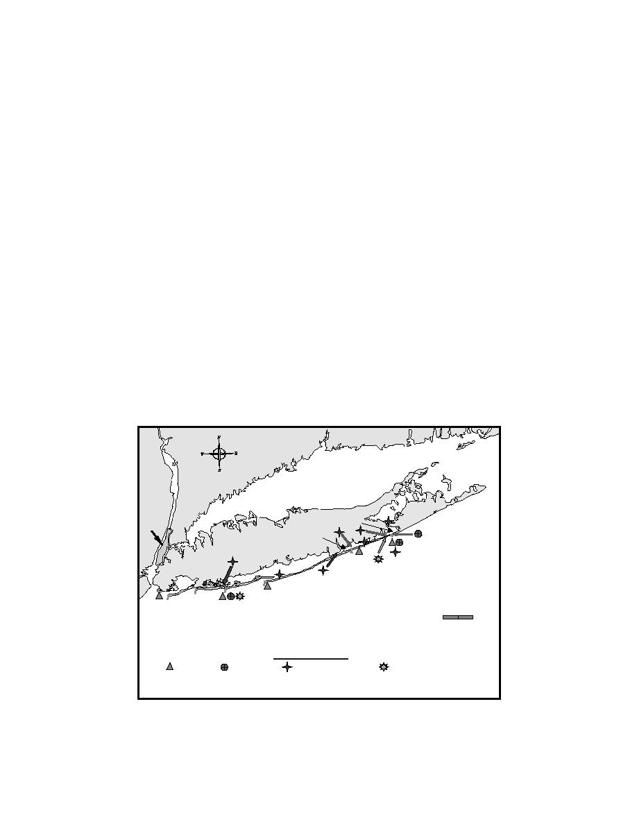
Presently, directional nearshore wave data are available at six locations within the Long
Island, New York coastal area (Fig. 1). Nearshore data are being collected from gauges at
Shinnecock Inlet, Westhampton Beach, Fire Island Inlet, Jones Inlet, and Coney Island. The
Shinnecock, Jones and Fire Island are pressure gauge-current meter (PUV) gauges and the
Westhampton and Coney Island gauges are pressure gauge arrays. Offshore wave data are
available from National Data Buoy Center (NDBC) Buoy 44025, upgraded to directional
capability through sponsorship of the Corps' New York District. The buoy is located about
25 nautical miles south of Fire Island Inlet. Table 1 lists the locations of the wave gauges.
All wave gauges except the Fire Island gauge, which is self-recording, report data in
near-real time via the World Wide Web for display, processing, and archiving. The
subsurface gauges are cabled to shore, where time-series data are transmitted to servers via
telephone landlines. Data from the PUV gauges are processed by the server applying
traditional spectral analysis techniques (Grosskopf, et al. 1983) and then added to the data
archive. The data collected by Buoy 44025 are made available by the NDBC on the web in
bulk parameter form. Because the spectra are not made available, they are synthesized for
model boundary input as described below.
Supplemental data are collected to enhance understanding of the coastal processes and
the accuracy of wave modeling, especially in the vicinity of tidal inlets (Fig. 1). Wind and
atmospheric pressure are measured at Shinnecock and Jones Inlets. Water level and current
measurements are also collected along the inlet/bay system because the nearshore wave
model can incorporate circulation model results to account for the wave and current
interaction at inlets (Smith, Resio, and Zundel 1999).
Block Island
Sound
Long Island Sound
Montauk
Point
Shinnecock
Bay
Manhattan
Moriches
Bay
Shinnecock
Long Island
Inlet
Moriches
Inlet
Great South Bay
Fire Island
E. Rockaway
Inlet
Jones
Rockaway Inlet
Scale
Inlet
Inlet
Atlantic Ocean
0
8
16
Kilometers
Instrument Legend
wave gauge;
current meter;
tide (water level) gauge;
meteorological station
Fig. 1. Long Island overall coastal monitoring system, 1998-2002.
3


 Previous Page
