

The initial pilot channel was assigned 50-m width and 0.25-m depth (from
the top of barrier island) based upon information obtained from local experts
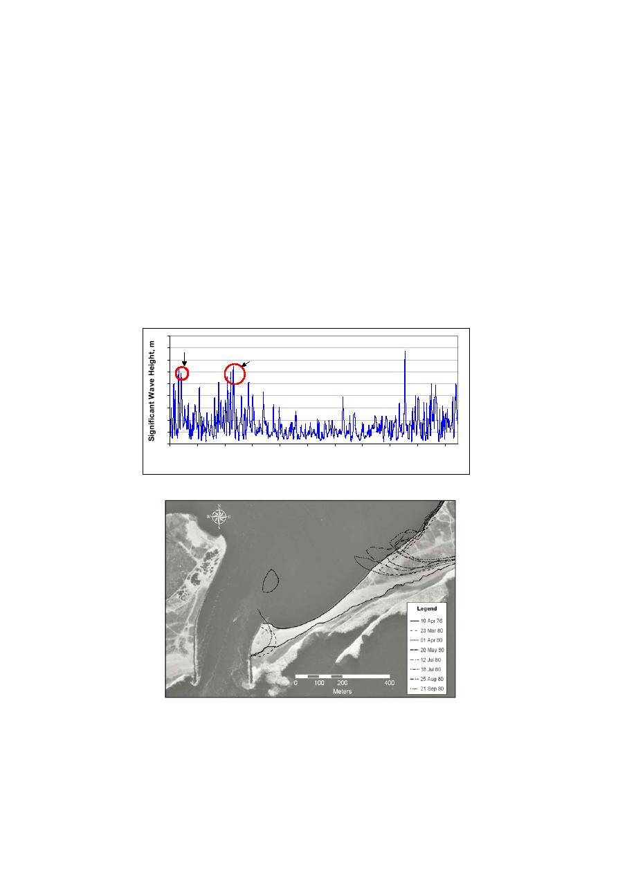
who monitored the breach. Inspection of aerial photographs indicated the
breach reached the east jetty in early May 1980, and maximum breach width of
850 m was achieved sometime between 18 July and 25 August 1980. After
maximum width was achieved, the breach narrowed slightly, attributed to
longshore sediment transport directed toward the west, which initiated spit
growth to the west. Depth across the breach was irregular, and shallow areas to
the east were not surveyed. Therefore, as representative depths, the area-
averaged value and the minimum value were compiled for comparison to
calculations.
9
Breach Start
8
Second Major Storm
7
6
5
4
3
2
1
0
1/1/80
2/5/80
3/11/80
4/15/80
5/20/80
6/24/80
7/29/80
9/2/80
10/7/80
11/11/80 12/16/80
Date (Jan 80 - Jan 81)
Figure 6. WIS wave record, Station 111, 1980
9

 Previous Page
