Monitoring Morphology and Currents at the Hatteras Breach
By
Ty V. Wamsley
U.S. Army Engineering Research and Development Center
Coastal and Hydraulics Laboratory
3909 Halls Ferry Road, Vicksburg, MS 39180
Ty.V.Wamsley@erdc.usace.army.mil
Kent K. Hathaway
U.S. Army Engineering Research and Development Center
Coastal and Hydraulics Laboratory
Field Research Facility, Duck, NC 27949
Kent.K.Hathaway@erdc.usace.army.mil
ABSTRACT
On 18 September 2003, Hatteras Island, North Carolina, was breached by
Hurricane Isabel about 6 miles northeast of Hatteras Inlet to connect Pamlico
Sound with the Atlantic Ocean. The breach occurred at a location of
minimum island width and elevation. As part of research on coastal inlets,
the new opening was surveyed to provide much-needed data on the hydrody-
namic and morphologic evolution of barrier island breaches. Two topo-
graphic and shallow water surveys were conducted 10 days apart to capture
short-term temporal changes in the breach morphology. Analysis of the
survey data indicates rapid morphology change. Ebb and flood shoals
formed within 2 weeks of the breach. The main breach channel widened by
as much as 125 ft and migrated to the west by as much as 80 ft in the 10 days
between surveys. Water levels on both the ocean and sound side of the
barrier were also measured. Current velocities were measured with surface
drifters and with an ADCP during two field deployments. Maximum current
velocities were on the order of 7 ft/sec. The surveys provide quantitative data
on the evolution of barrier island breaches that will be applied in develop-
ment of numerical models of coastal breaching.
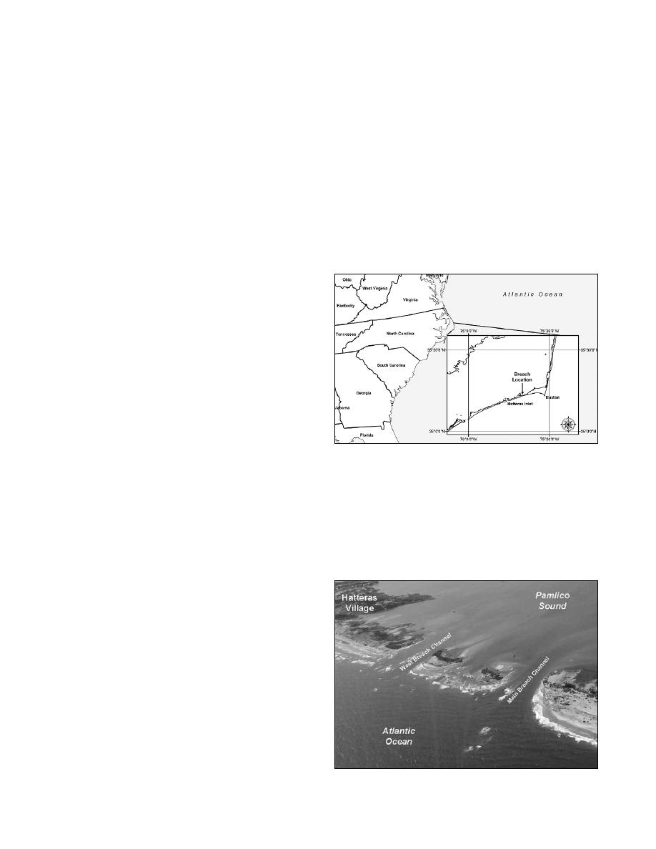
Figure 1. Location map for Hatteras breach.
Additional Keywords: ADCP, barrier island, bathymetry, Hurricane Isabel,
and the predominant wave direction is from south to southeast.
inlet, Pamlico Sound, survey
The mean tide range in this area, measured at the Cape Hatteras
INTRODUCTION
Fishing Pier, is 3.05 ft and spring tide range is 3.53 ft.
H
urricane Isabel made landfall along the North Carolina
A coastal breach is a new opening in a narrow landmass such
Outer Banks on 18 September 2003. The eye came
as a barrier island that allows water to flow between water bodies
ashore between Cape Lookout and Ocracoke Island, near
on either side of the barrier. Unintended breaches occur around
Drum Inlet. Isabel was a Category 2 storm on the Saffir-Simpson
the coast of the United States each year and are a serious concern
scale with maximum winds of approximately 100 mph and
in developed areas or areas of critical habitat (Kraus and
produced storm surges 6.5 to 8 ft above normal tide level near the
point of landfall. The storm breached Hatteras Island about 6
miles northeast of Hatteras Inlet between the villages of Hatteras
and Frisco (Figure 1). The Hatteras breach quickly widened to
an overall width of over 1,500 ft. The breach contained two
"breach islands" that created three distinct breach channels
(Figure 2). During a 1933 storm, a breach occurred at nearly the
same location. A bridge was being built over the new inlet in the
1930s, but the inlet closed naturally before the bridge was
finished and construction was stopped. The U.S. Army Corps of
Engineers (USACE), Wilmington District mechanically closed
the breach created by Hurricane Isabel on 1 November 2003
(Wutkowski 2004).
This section of Hatteras Island is characterized by having
medium-fine sand from the mean high water (MHW) line to 6 ft
depths. The average significant wave height, as determined by
the Wave Information Study (WIS) Level 3 for 10 years (1990-
1999) at station 262, is 3.6 ft with a standard deviation of 2.3 ft.
Figure 2.
Hatteras breach, 22 September 2003 (USACE
Mean wave period is 6 sec with a standard deviation of 2.4 sec,
Wilmington District photograph).
Shore & Beach Vol. 72, No. 2, Spring 2004, pp. 9 - 14
9


 Previous Page
