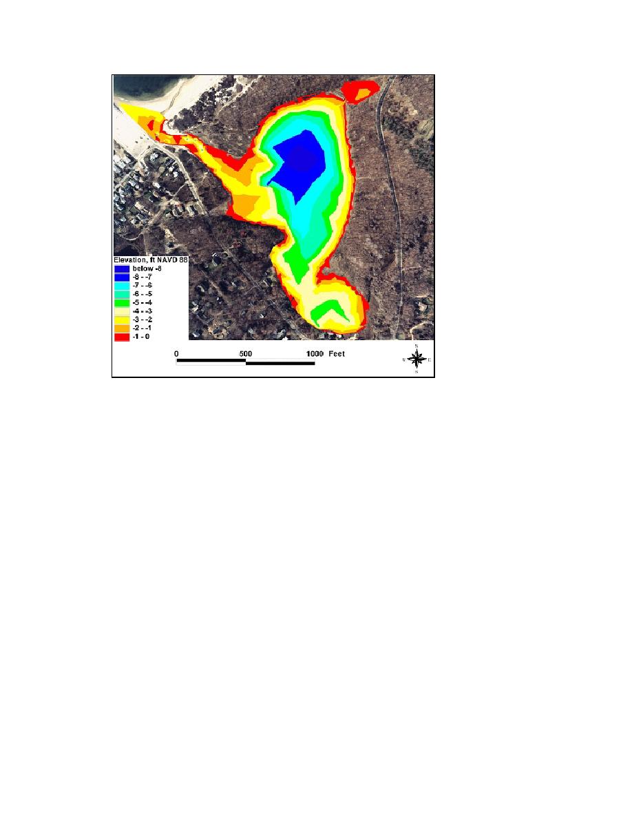
Figure 3-40c. Goldsmith Inlet contours at high tide, 8 October 2002
Channel morphology. The entrance channel at Goldsmith Inlet is narrow and
shallow. Depths range between 1 and 4 ft NAVD88, and a large in-channel bar
formation in the center of the channel becomes exposed during low tide (Figure 3-41).
The channel has been observed to contain running water at all times during numerous
field visits. At the time of the 6-8 October 2002 survey, the channel was 12 ft wide at the
entrance to the Long Island Sound and expanded to 100 ft at the entrance to Goldsmith
Pond.
An attached shoal is located approximately 800 ft into the inlet on the west bank.
Sediment entering the inlet attaches to the inlet bank, occupying a portion of the inlet
channel (Figure 3-42). Sediment entering the inlet during flood tide is inferred to have
formed this feature. This attachment on the west bank may redirect the ebb and flood
tidal current and decrease the flushing capacity of the inlet. Sediment also approaches
the inlet entrance from the spit that forms adjacent to the jetty. The entrance channel
tends to align to the east, a characteristic that has become more pronounced with growth
of the attachment shoal and the buildup of sediment along the jetty.
Transects were extracted from the 8 October 2002 survey. Because Goldsmith Inlet
is shallow, the survey was made based on changes in relief. Two-dimensional (2-D)
transects were created from a three-dimensional (3-D) bathymetry grid to analyze of the
morphology of Goldsmith Inlet. The transect lines are displayed in Figure 3-43, and
channel cross sections are shown in Figures 3-44a through 3-44c. Figure 3-44a displays
the shallow water at the inlet mouth. A longitudinal linear shoal that is dry during low
tide can be seen in Transects 2 and 3. The relatively large attached shoal that has formed
84
Chapter 3 Field Data Collection and Analysis


 Previous Page
