

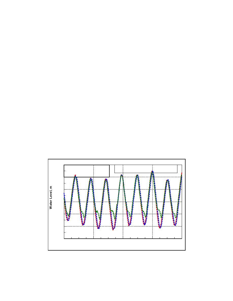
Calculated tidal water levels exhibit strong asymmetric behavior at
Goldsmith Inlet. Figures 5-24a through 5-24f plot water level at selected nodes
along the inlet channel and the total discharge at each of these nodes. Each
figure plots nodes against the input boundary condition (Node 1) and calculated
elevation at a selected preceding node. The figures contain comparisons for a
spring tide, 5-8 October 2002.
At nodes located near the forcing in Long Island Sound, the water-level
signal is sinusoidal. With distance into the inlet, the water-level signal becomes
more asymmetric, achieving a greater maximum on flood than on ebb, and with a
shorter time of flood than ebb. Such water-level behavior is called flood
dominance. There are three possible contributions the asymmetry. The first and
likely dominant contribution is the presence of sills in the inlet. The higher water
of flood can enter the inlet rapidly, because the tide wave celerity is given by the
square root of the product of gravitational acceleration and depth. On the lower
water of ebb, the depth is less, and the water flow must be slower. Connected
with this hypsometric change in wave speed is the fact that bottom friction will
retard flow more strongly for shallower water.
A second contribution to the asymmetry in water-level signal in the inlet and
pond is the preferential drainage in the wetland surrounding Goldsmith Pond. It
is expected that flooding water will enter the wetland more rapidly than the
draining water on ebb. A third contribution for the asymmetry is the nonlinear
interactions of flow components introduced by the bottom friction terms and
advective terms in the equations of motion.
1.5
Goldsmith Inlet Calculated Water Level
------ Measurements
Offshore, Node 5, Node 8
------ DYNLET Calculations Node 5
------ DYNLET Calculations Node 8
1.0
0.5
0.0
-0.5
-1.0
-1.5
10/7
10/5
10/6
10/8
10/9
5 - 8 October 2002
Figure 5-24a. Water-level measurements offshore of Goldsmith Inlet and
DYNLET Nodes 5 and 8 calculations, 5-8 October 2002
250
Chapter 5 Circulation Analysis

 Previous Page
