

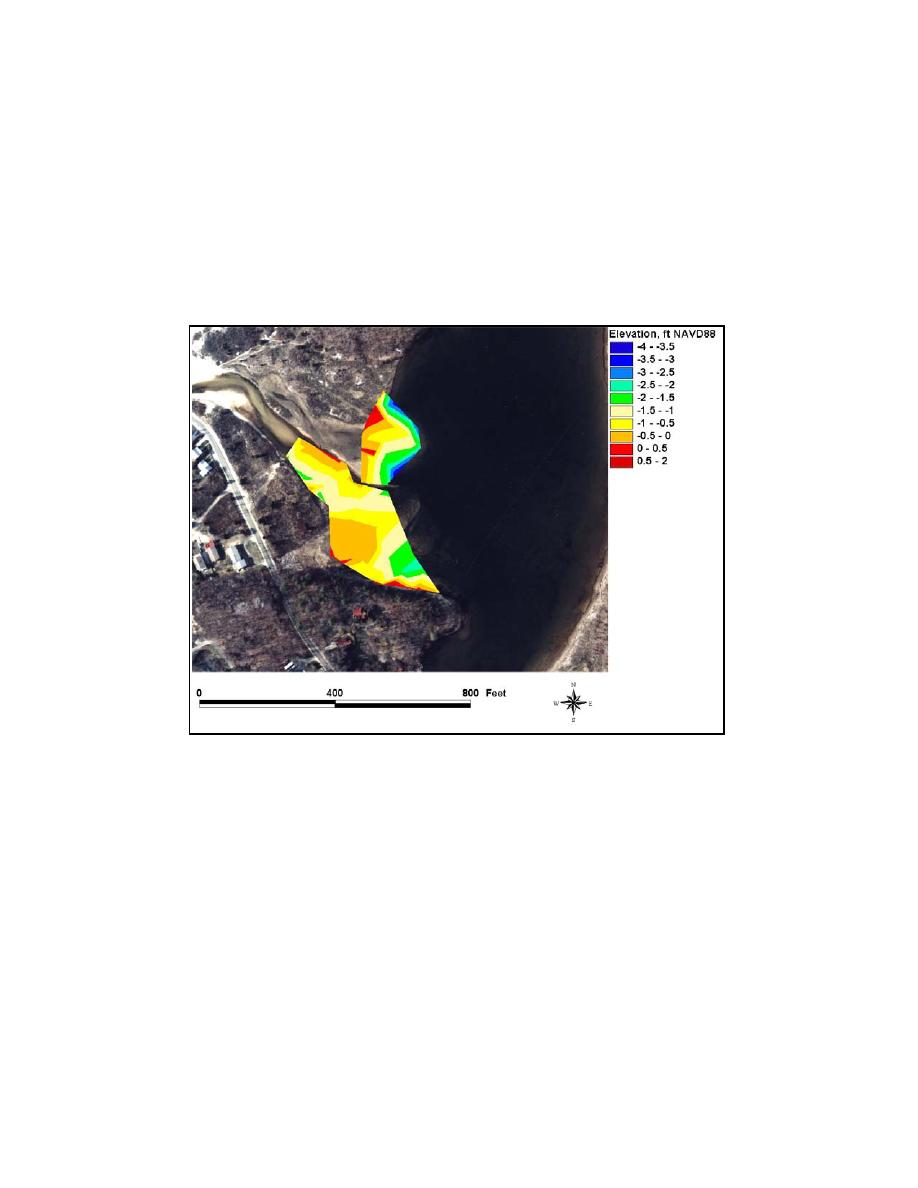
Because the ambient depth in the eastern portion of Goldsmith Pond is
greater than in the western portion and within the channel, two polygons were
created to estimate the total volume of the flood shoal. One polygon
encompassed the west and channel lobe, and the other encompassed the east lobe.
No area was found that contained a clearly identifiable ambient depth, so the
ambient depth was approximated from depths surveyed adjacent to each polygon.
This depth was multiplied by the surface area of each lobe, yielding the volume
of water located above each idealized "no-shoal" bathymetry.
Figure 6-10. Shoaling at Goldsmith Inlet and Goldsmith Pond, 8 October 2002
A TIN was generated for each polygon and the volume of water located
between each TIN and the NAVD88 datum was calculated. Subtracting the
volume of the water found above each TIN from the value that represented an
ambient water volume yielded an estimate of the volume of each lobe. The
estimated ambient depths for the west lobe and channel lobe are 2.0 ft, and the
estimated ambient depth for the east lobe is 4.5 ft. The volume of the west lobe
was calculated to be 2,915 cu yd and the volume of the west lobe was calculated
to be 3,715 cu yd. Quantities used to determine this estimate are summarized in
Table 6-7.
283
Chapter 6 Inlet Morphology and Stability

 Previous Page
