January 13, 2004
14:38
WSPC/101-CEJ
00092
Recent Developments in the Geomorphic Investigation
589
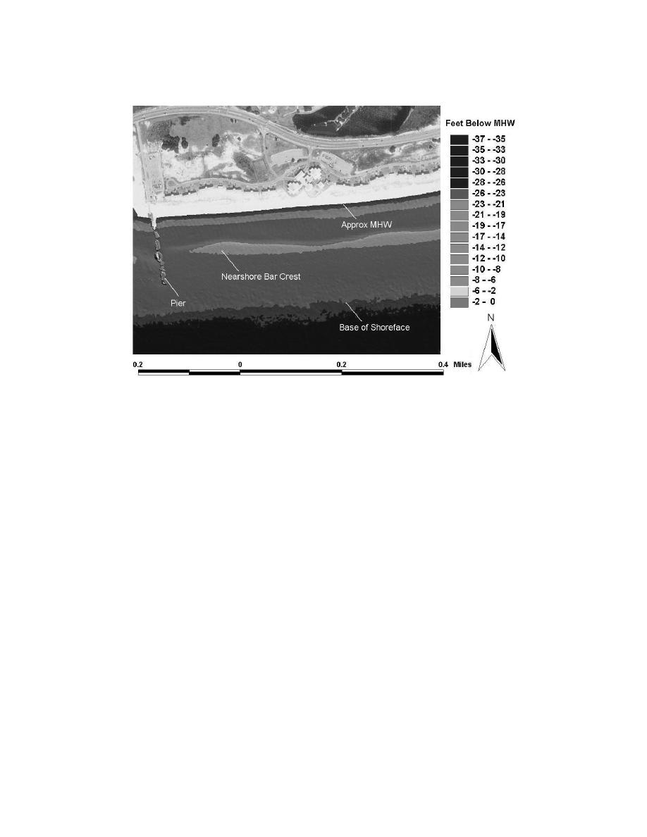
Fig. 18. GIS presentation of LIDAR data showing the details of the shore face at Gulf Shores State
Park, Alabama. LIDAR data are superimposed on USGS digital ortho imagery.
and GIS to provide a tool for calculating shoreline sediment budgets. Another ex-
ample of combined remote sensing and GIS methods in coastal engineering is a
toolbox for handling large arrays of LIDAR data in a customized GIS platform.
The SHOALS Toolbox (Wozencraft et al., 2002) allows relatively automated ma-
nipulation and plotting of LIDAR-based topographic data collected from beach and
nearshore zones. Figure 18 is an example of a GIS presentation of LIDAR data su-
perimposed on a USGS DOQQ image of Gulf Shores State Park in Alabama, USA.
The 4-m spatial resolution of the LIDAR data allows the details of the near shore
bar system and coastal structures to be easily identified.
2.9. Image analysis methods
The aerial photographic record for many coastal regions extends back to the 1940s
and even earlier for some locations. Such documentation often contains informa-
tion about coastal morphology prior to major engineering projects. This is particu-
larly true for tidal inlets since historical photographs can provide quantitative data
on coastal morphology pre- and post-jetty construction. Photographs thus contain
substantial information about the response of the inlet and nearshore morphology to
navigation channel operation and maintenance activities. An additional advantage
is that historical aerial photographs can usually be obtained at a relatively low cost


 Previous Page
