Rapid Response 3D Survey Techniques for Seamless Topo/Bathy
Modeling: 2003 Hatteras Breach, North Carolina
By
Christopher W. Freeman, David J. Bernstein
Geodynamics: Geologic and Oceanographic Services
915 North Yaupon Terrace
Morehead City, NC 28557
chris@geodynamicsgroup.com
dave@geodynamicsgroup.com
Helena Mitasova
North Carolina State University
Marine, Earth and Atmospheric Sciences Department
Raleigh, NC 27695
helena_mitasova@NCSU.edu
ABSTRACT
On 18 September 2003, Hurricane Isabel made landfall along the Outer
Banks of North Carolina and created a breach in the barrier island chain south
of Cape Hatteras. The breach isolated the community of Hatteras Village by
washing out a 500-m section of North Carolina State Highway 12 (NC12).
To rapidly assess breach geomorphology, document short-term morphologi-
cal evolution, and to collect data in support of coastal modeling efforts, a
series of high-density topographic and bathymetric surveys were performed.
The unique three-dimensional (3D) survey design utilizes real-time kine-
matic GPS and ultra shallow-water singlebeam and multibeam sonar tech-
nologies. The integration of these technologies with specialized acquisition
and processing techniques allows for a seamless merger of high-resolution
beach and nearshore data within the surf zone. Processing the approximately
1.5 million data points into accurate 3D digital elevation models (DEMs),
representing shoreline topography and nearshore bathymetry with strong
anisotropy, provides a unique challenge that is handled with specialized
interpolation algorithms used in both proprietary and open source GIS.
Rapid 3D processing and GIS integration provided the U.S. Army Corps of
Engineers (USACE) Wilmington District office with information to assess
and engineer the breach closure and provided researchers of coastal processes
with information that could not be adequately captured with traditional 2D
techniques.
Additional Keywords: RTK-GPS, digital elevation models, shallow-water
sonar, GIS, Hurricane Isabel
INTRODUCTION
O
n 18 September 2003, Hurricane Isabel made landfall
along the Outer Banks of North Carolina and created a
breach in the barrier island chain south of Cape Hatteras,
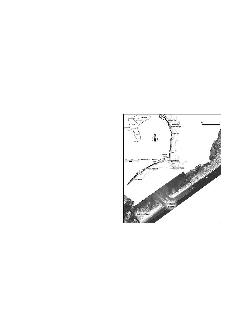
Figure 1. Study location.
NC (Figure 1). To rapidly assess breach geomorphology,
the collection of detailed topo/bathy data at the site of a natural
document short-term morphological evolution, and collect data
disaster, and (3) illustrate how specific 3D topo/bathy processing
in support of engineering and research efforts, a series of high-
routines within various GIS platforms helped produce accurate
density topographic and bathymetric (topo/bathy) surveys were
morphological information that could assist in the design of the
performed. The first topo/bathy survey was completed over the
breach closure.
period of 3-5 October and the second survey from 13-16 October
2003. Mapping the breach and surrounding areas presented
ACQUISITION METHODS
many challenges due to the logistics of working in a severely
storm-damaged environment. To overcome challenges such as
The goals of the field surveys were to assess the breach and
submerged and floating debris, high-velocity tidal and wind-
surrounding morphology quickly and with as much detail as
driven currents, and loss of infrastructure required a coordinated
possible. The collection of high-resolution topo/bathy data in the
survey design and strategy. Specific objectives of this paper are
vicinity of the Hatteras breach required a mode of data collection
to: (1) detail the rapid response 3D acquisition systems and
that could span the beach, surf zone, and extremely shallow
methodology implemented at the site of the Hatteras breach, (2)
reaches of the breach shoals rapidly and accurately. To
highlight the unique and flexible survey strategy employed for
Shore & Beach Vol. 72, No. 2, Spring 2004, pp. 3 - 7
3


 Previous Page
