

Figure 3. Photograph illustrating the survey design by which the
subaerial beach was mapped. Morphologically derived survey
paths were driven to collect critical data between standard beach
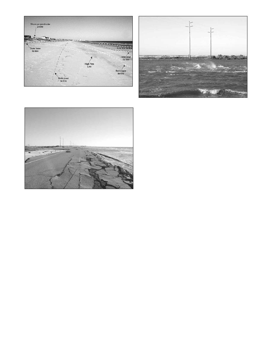
Figure 5. Photograph illustrating high velocity tidal currents,
profiles.
wind-driven currents, and waves within the main breach channel.
propelled survey platform allowed for the collection of accurate
hydrographic data at speeds of up to 10 knots in a variety of
extreme physical conditions across the breach, flood tidal delta,
and surf zone.
Swath bathymetry surveys at the breach were performed for
submerged object detection, for detailed bathymetry within the
main breach channel, and to measure the offshore gradient
outside the quickly forming ebb tidal delta. Multibeam sonar
data was collected aboard the R/V 4-Points; a custom Carolina-
built 8 m research vessel specifically designed for shallow water
multibeam sonar operations (Figure 2d). The R/V 4-Points draws
less than 30 cm of water and is outfitted with twin four-stoke
outboard engines to provide superior maneuverability in shallow
or constricted bodies of water like the Hatteras breach. The
vessel is equipped with a Simrad EM3000 multibeam sonar
system combined with a VT TSS Meridian Surveyor
Figure 4. Photograph illustrating the debris within the central
gyrocompass and DMS-05 motion reference unit. Critical sound
portion of the breach. Asphalt from NC12 and broken utility lines
velocity data is collected with an Odom Digibar Pro. Raw
covered extensive areas (looking northeast).
multibeam sonar data is acquired and processed in Triton Elics
To accurately model topographic data in three dimensions and
International software.
to extract datum-derived shorelines requires the collection of
To quantify and limit error in the hydrographic survey, a
elevation data along breaks in morphology (Bernstein et al. 2003;
number of hydrographic calibration procedures were performed,
Freeman et al. 2003). Along the beachface adjacent to the
including the collection of sound velocity profiles spatially
breach, this requires the systematic collection of data from the
across the survey area, a detailed multibeam patch test,
base of the dune to the lowest tide line (Figure 3).
crosscheck error analysis, and daily "bar checks" of the
Morphological features such as scarps, cusps, and berms were
singlebeam. In addition to the "bar check", the singlebeam
bracketed to provide accurate calculations of volume and change
system was calibrated with a direct seafloor elevation
between the two surveys. Isolated portions of land within the
measurement derived from an RTK-GPS rover.
center of the breach were surveyed in a circular pattern from the
lowest tide perimeter to the center. Walking the morphology
SURVEY STRATEGY
breaks in this area became challenging due to the dense debris
field, including building materials and destroyed portions of
In order to accurately document the morphology and
NC12 (Figure 4).
bathymetry change at the site of the Hatteras breach, a
comprehensive survey strategy was developed to provide the
Bathymetry
most flexible and cautious means of collecting these data within
Due to the extremely shallow nature of the site surrounding the
the disaster area. Upon arrival to the survey site, a pre-survey
breach, the bulk of bathymetric data could best be collected with
logistics meeting at the USACE Field Research Facility was
a personal watercraft outfitted for shallow water surveying
conducted in order to detail the project goals and resolve possible
(Beach, Holman and Stanley 1996; MacMahan 2001; Wamsley
logistical problems such as lodging, food, power, and outside
and Edge 2001). The Surfzone Explorer (Figure 2c) is a Yamaha
support. Once these details were finalized, reconnaissance of the
four-stroke Wave Runner equipped with an Odom HT 100 ultra-
survey area began in order to determine site-specific
shallow water singlebeam sonar system compensated for motion
complications that might be encountered, locate survey control,
(with a VT TSS DMS-05 sensor) and sound velocity (with an
begin the RTK-GPS site calibration, and identify a staging area.
Odom Digibar Pro). This combination of instruments and jet-
Field reconnaissance at the survey site revealed high-velocity
Shore & Beach Vol. 72, No. 2, Spring 2004, pp. 3 - 7
5

 Previous Page
