cross-section B is directly adjacent to, and partially cuts through the east flood
shoal.
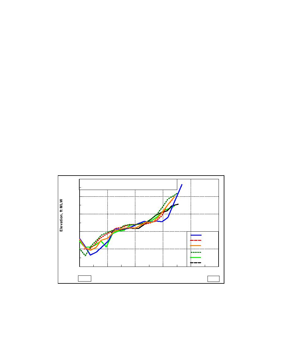
Cross-section A shows areas of scour on the west side of Mattituck Inlet,
with channel depths averaging 15 ft. A high degree of variability is indicated.
The variability may be the result of differences in survey position, although it is
possible that these changes reflect episodes of scour at specific times. Bank
encroachment can be seen on the east wall of the navigation channel. Referenced
to a depth of 5 ft mlw, sediment accumulation has added approximately 25 ft to
the eastern wall of the navigation channel over the 10-year period. This estimate
seems reasonable and is supported by the trend over time seen in this figure.
Referenced from the center of this cross section, the figure indicates that channel
infilling added 1.5 ft of sediment to the channel bottom. Although this value is
within survey error, it is consistent with previous assessments of sediment
accumulation.
Cross-section B is directly adjacent to the east flood shoal and shows similar
trends of scour along the west bank and infilling within the channel, although
depths along the areas of scour are not as great. Bank encroachment along the
east wall of the navigation channel is more pronounced. Referenced at a depth of
5 ft mlw, sediment deposition added approximately 50 ft to the eastern wall of
the Federal navigation channel over the 10-year period.
5.0
Mattituck Inlet Navigation Channel Cross-Section
May 1980 through March 1990
0.0
-5.0
-10.0
May 1980
Aug 1983
Jun 1985
-15.0
Sep 1987
Nov 1989
Mar 1990
-20.0
0
50
100
150
200
250
WEST
EAST
Distance Across Channel, ft
Figure 4-39a. Mattituck Inlet channel cross-section A
165
Chapter 4 Morphology Change, and Channel Shoaling and Migration


 Previous Page
