

5.0
Mattituck Inlet Navigation Channel Cross-Section
May 1980 through March 1990
0.0
-5.0
-10.0
May 1980
Aug 1983
Nov 1989
Mar 1990
-15.0
0
50
100
150
200
250
WEST
Distance Across Channel, ft
EAST
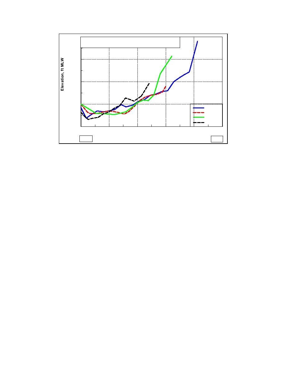
Figure 4-39b. Mattituck Inlet channel cross-section B
Cross-section C (Figure 4-39c) provides information on the present
morphology of Mattituck Inlet and is close in location to cross-section A. For
comparison to previous figures, the cross section from May 1990 has been
included. The cross section of May 1990 is from a pre-dredging survey, and the
cross section of October 1990 is from a post-dredging survey. Cross-section C
tracks changes in channel width from May 1990 to 2 June 2002. Referenced to a
depth of 5 ft mlw, the east bank appears to have grown only 6-7 ft in thickness
from October 1990 to 20 June 2001. The 2002 survey at this location shows no
indication of growth. Because the other cross sections indicate a trend of bank
encroachment, this cross section was not included in the calculation. The 2 June
2002 cross section does, however, indicate encroachment below this reference
that generally agrees with the bank encroachment indicated in the other cross
sections.
A large of amount of shoaling can be seen along the west bank on cross-
section C, and this portion of the shoal was not dredged in October 1990. This
portion of the flood shoal was presumably allowed to grow because it was not
located within the navigation channel. The eastern edge of the navigation
channel starts at approximately 40 ft into the cross sections shown. The shoaling
indicated did not begin to encroach upon the navigation channel until the mid-
1990s. These cross sections indicate that the east wall of the channel encroached
approximately 10 ft between March 1999 and 2002.
166
Chapter 4 Morphology Change, and Channel Shoaling and Migration

 Previous Page
