W. Huang et al. / Ocean Engineering 30 (2003) 22752295
2290
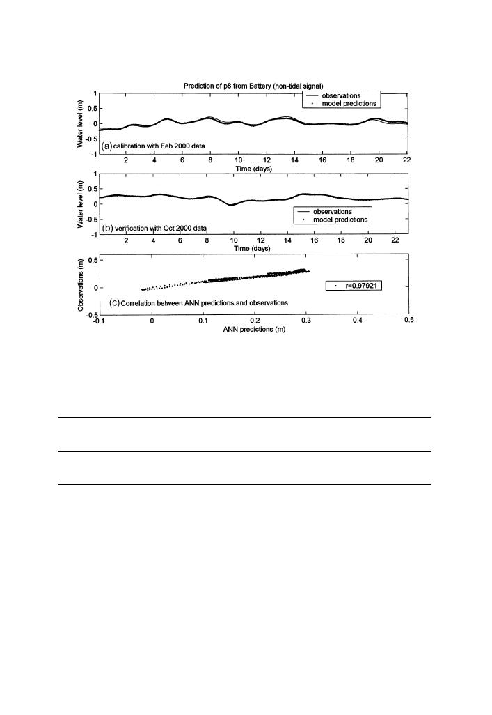
Fig. 11. Model test for non-tidal water level predictions at station P8. The distance between input NOAA
station at Battery and the local station is about 90 km.
Table 4
Statistics Summary of comparison between model predictions and observations of low-frequency, non-
tidal water levels
Output Station
Input NOAA
Training
Verification
Correlation
Root-mean-square
station
period
period
value (r)
error (m)
P2
Montauk
01/1999
04/1999
0.988
0.0280
P8
Battery
02/2000
10/2000
0.979
0.0170
the minimum distance to the local station P2 at Shinnecock Inlet is about 234 km
from Atlantic City, New Jersey; and the maximum distance is 591 km from Duck,
North Carolina. Stations of Atlantic City and Duck are located on the coast. The
Lewisetta Station is located in the Chesapeake Bay Estuary, in which estuarine top-
ography has an effect on tidal waves.
A summary of validations of model performance is given in Table 5. Using inputs
of water levels from the coastal station at Atlantic City (234 km away from the local
station), model predictions are very good, with a 0.98 correlation value and 0.05 m
root-mean-square error. As the distance increase, the prediction accuracy slightly
decreases. Using inputs from the farthest station at Duck (591 km away), the RNN--
WL model give reasonable predictions, with a 0.97 correlation value and 0.08 m


 Previous Page
