

Inlets Online is a web-based information and analysis resource on tidal inlets and adjacent
beaches, Great Lake entrances, navigation channels, and Corps of Engineers operation and
maintenance activities at these sites. Inlets Online is intended to provide technical guidance for
non-specialists and to serve as an information center for specialists in the areas of coastal
engineering, coastal geology, oceanography, and coastal zone management. Presently, the web
site includes technical documentation related to aerial photographic interpretation, historical
information on federally maintained inlets, and examples of features interpreted from
photographs (Byrnes et al. 2002). Inlets Online includes a database of historical aerial
photography for federally maintained inlets, and it is being expanded to non-federal inlets.
Inlets Online is a tutorial for identifying coastal features from aerial photography, how they
are measured and analyzed, and how they are related to specific inlet/beach processes. It is also
a historical aerial photography database for inlets around the United States. Inlets Online is
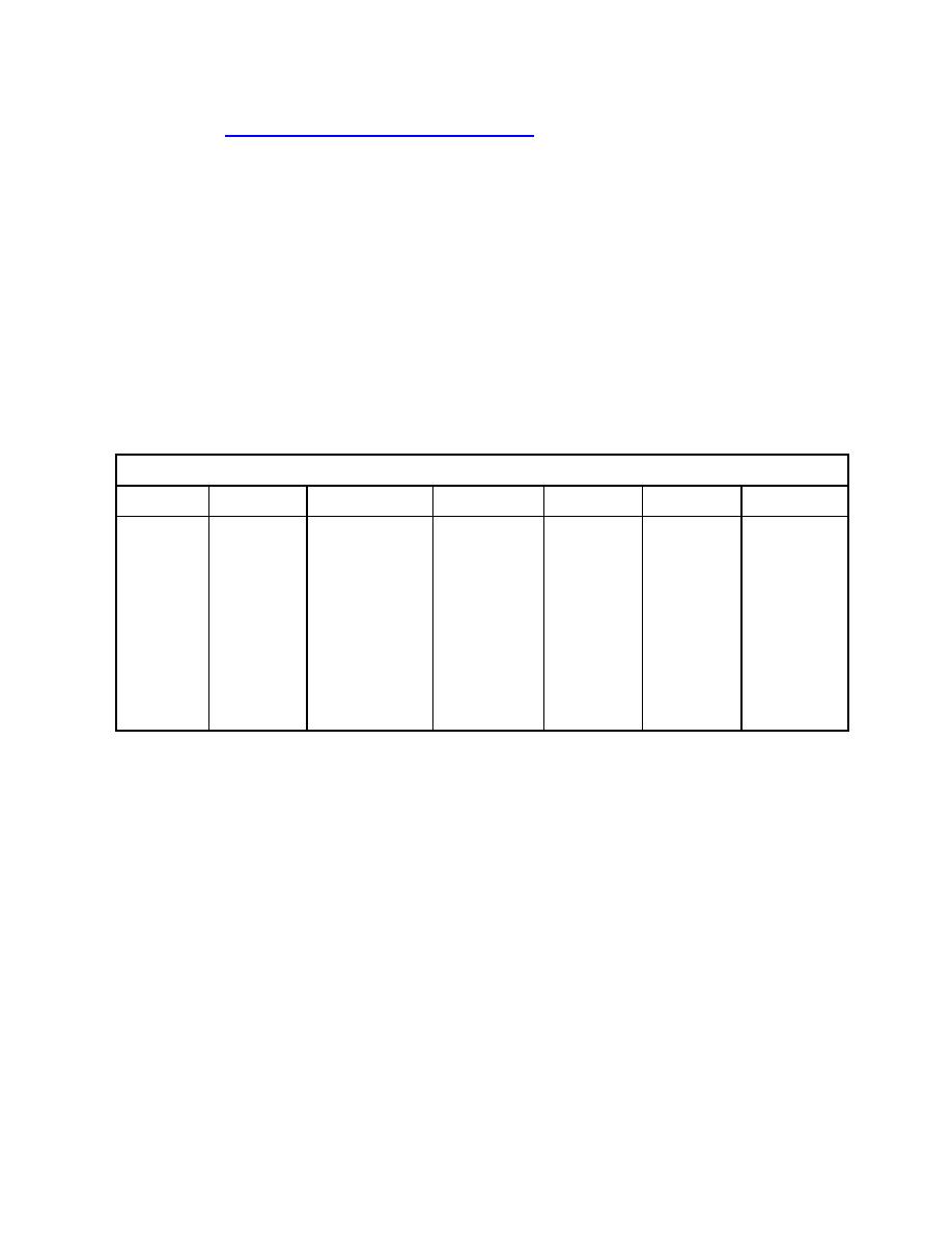
organized into seven components within the framework listed in Table 2.
Table 2. Framework for Inlets Online
Inlet/Beach
Inlet/ Beach
Engineering
Glossary of
Analysis
Analytical
Select a Site
Processes
Morphology
Activities
Terms
Methods
Toolbox
Coastal
Wave-current
Documents
Storm
Structure
Interpretation
Links to
engineering
interaction
154 federal
response
placement
of aerial
screening
inlets and
photography
codes and
Geology
Channel
Shoals
Structure
many non-
decision-
navigability
performance
Oceanography
Hard bottom
federal inlets
support tools
Sediment
Structure
Coastal zone
Channel
transport
rehabilitation
management
orientation
Wave
Channel dredging
Deposition basin
Beneficial uses of
dredged material
Sand transfer plant
Inlets Database
The CIRP's Database of Inlet Navigation Projects and Structures is a web-server-hosted
database accessed via a customized web interface (Hughes 2000a). The database contains more
than 1,230 individual records of navigation structures and tidal inlets located around the
coastlines of the United States and its territories, including 330 records from the U.S. Great
Lakes. Fig. 6 shows the web interface and a partial listing of records beginning with the letter C.
The original database was extended by adding more than 900 digitized historic photographs
of tidal inlets and associating them with a database record. Users can construct custom queries
and download the tabulated results. Recently, extensive inlet data have been gathered for 154
federally maintained inlets and channels. Work is underway to separate the inlets and structures
databases and add cross-links between each inlet and its associated navigation structures. The
database will be expanded by including additional data fields and populating vacant fields where
possible. Each record has fields for parameters related to the inlet or to the inlet structure. Data
fields are grouped into three categories:
6

 Previous Page
