

consequences of mining of the flood shoal could be evaluated, and it was found that an 8-year
"recharge" time was needed to replace the 400,000 cu yd of sand proposed to be mined. Fig. 12
indicates that the inlet ebb shoal volume will not reach equilibrium for another 100 years.
Inlet Engineering Investigations
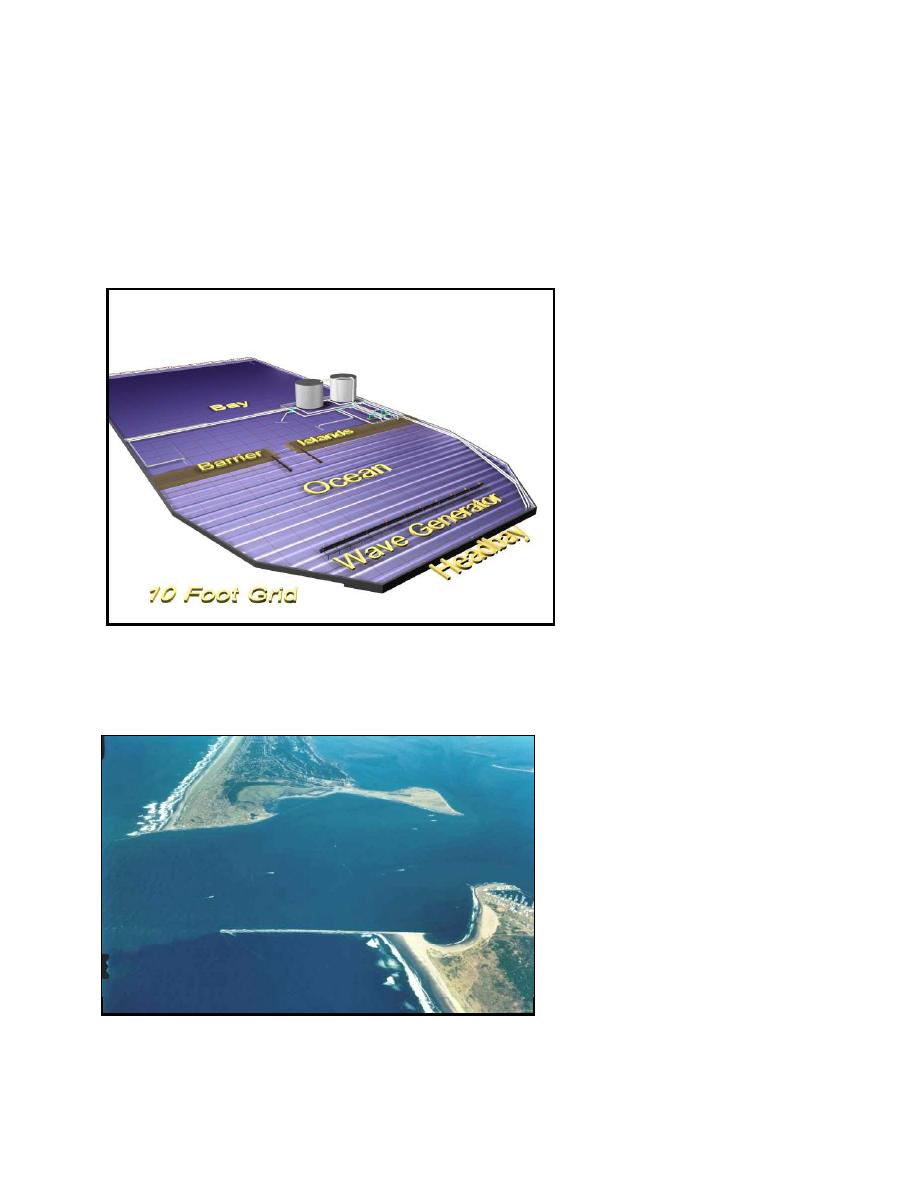
This work unit's focal point is a physical modeling facility dedicated for coastal inlet
research (Fig. 13). The 46 by 99 m facility contains an idealized inlet with simple contours for
basic research, but can be adapted for site-specific studies. Waves, tides, tidal currents and
sediment
movement
are
reproduced.
Studies have
included tidal current and wind-
wave interaction, current patterns
at John's Pass, FL, inner-bank
erosion
research,
sediment
pathways study, general study of
spit migration at inlets, design of
a wave diffraction mound at
Grays Harbor, WA, inlet
channel
area
experiments, and wave height
and direction measurements of
wave diffraction-refraction at
inlet structures.
Also a PC
program for determining inlet
channel
equilibrium
area
dimensions was developed with a
Fig. 13. CIRP idealized inlet physical model facility
user-friendly interface.
Inner bank erosion is a typical
example of an applied study in the
CIRP model.
Many inlets
(including Atlantic, Gulf, Pacific
and Great Lakes coastal inlets)
where a jetty terminates in sand or
silt develop an erosion area at the
Grays Harbor
termination point if the region is
sediment deprived. Fig. 14 shows
Inner-bank erosion
an example of this erosion at Grays
South jetty
Harbor, WA. The erosion area,
called Half Moon Bay, developed
over a 20-year period. Coupled
Pacific Ocean
with the recession of the ocean side
beach, a breach occurred in 1993,
cutting through the thin section of
Fig. 14. Example of inner-bank erosion at Grays Harbor, WA
sand, exposing the local area to
11

 Previous Page
