Sediment
The New York District collected 16 sediment samples at Mattituck Inlet and
Mattituck Creek on 6 and 7 May 2003. The sampling locations are shown in Figure 3-25.
Of the samples, two (MH7 and MH9) were not analyzed and are not shown. The
location of sample MH14 was uncertain and is not shown. Inspection of samples MH11
through MH16 (taken from the southern portion of Mattituck Creek) indicated that they
contained more than 90 percent silt and clay, so they were not further processed. The
upper and lower portions of samples MH5 and MH8 were analyzed separately because
substrate layering was apparent.
Only the results of the upper portion are presented here for the data interpretation to
be consistent with surface samples taken at Goldsmith Inlet. The New York District
(2003) analysis presented the data grouped in United States Department of Agriculture
(USDA) particle size classes. These results are presented here in phi units. Selected φ
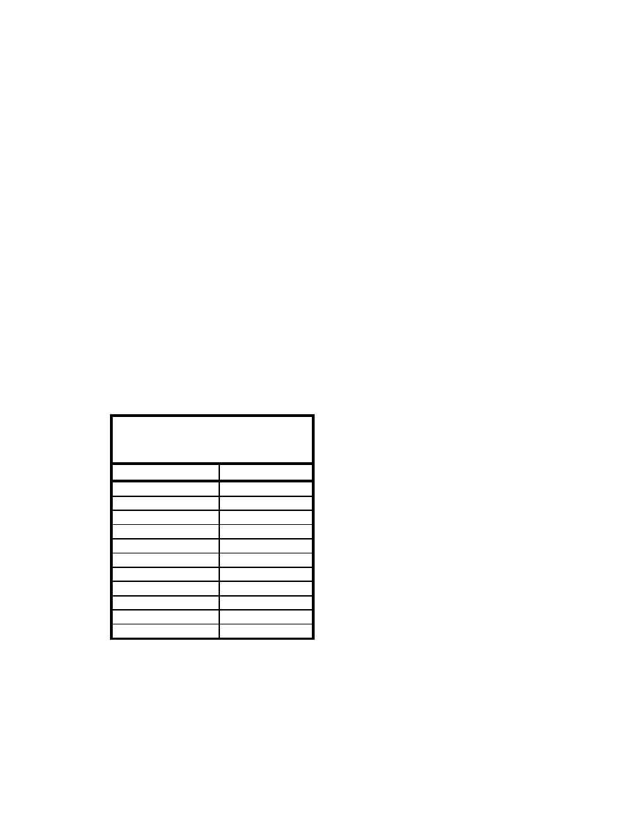
unit conversions to millimeters are given in Table 3-1. Figures 3-26a and 3-26b show the
cumulative grain size for all the samples that were analyzed.
Sediment from the Federal navigation channel near the mouth of the inlet consists of
a mixture of coarse, medium, and fine sand (0 to 3 φ). Sediment from the west side of the
Federal navigation near the landward edge of the west jetty (an area of shoaling)
consisted of gravel and coarse sand (> 0 φ). It is inferred that this is an area where the
flood current initially deposits much of the sediment brought into the inlet. The gravel
and coarse sand remains as a lag deposit under the action of waves striking shore after
entering the inlet, and finer (sand-sized) sediments are transported further into the inlet.
Table 3-1
Phi (φ) Units and Millimeter (mm)
Equivalents
Phi (φ) Units
Millimeters
-6
64
-5
32
-4
16
-3
8
-2
4
-1
2
0
1
1
0.5
2
0.25
3
0.125
4
0.0625
69
Chapter 3 Field Data Collection and Analysis


 Previous Page
